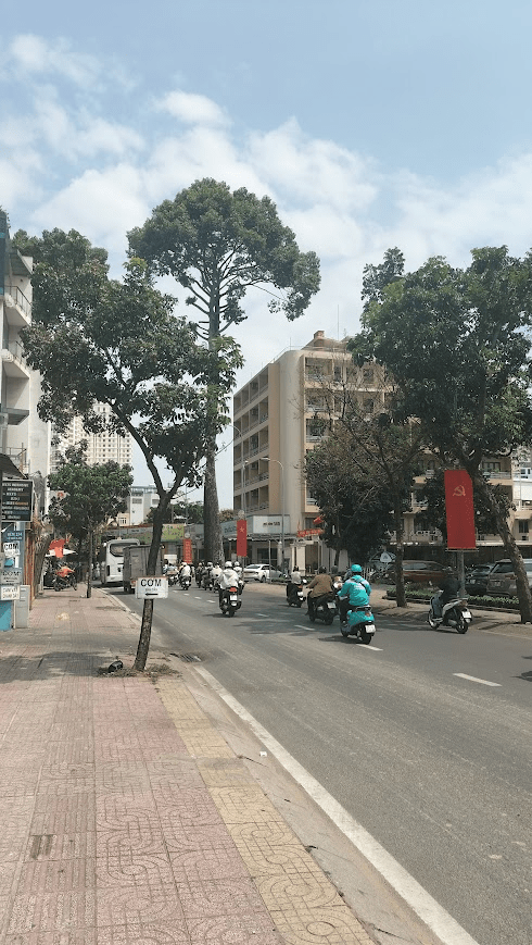
You haven’t seen a bad school run until you’ve seen it in Tân Phú, Ho Chi Minh City. Each morning at seven the alleys clog with motorbikes pressing through like sheep herded through a narrow lane. I plan my commute to work to be very early to avoid this rush. Then I wait for school to start in a pavement café in the shade of a banyan tree. Sipping coffee and planning lessons, I watch the chaos unfold along Lũy Bán Bích street.
As a proud nerd, it did not take long for me to start wondering about the street name “Lũy Bán Bích”. Vietnamese streets are often small monuments to history, commemorating people such as military leaders, poets, or revolutionaries. However, I learned that Lũy Bán Bích was not a person at all. Lũy means rampart, and the full name of the road translates roughly as the “half rim rampart.”
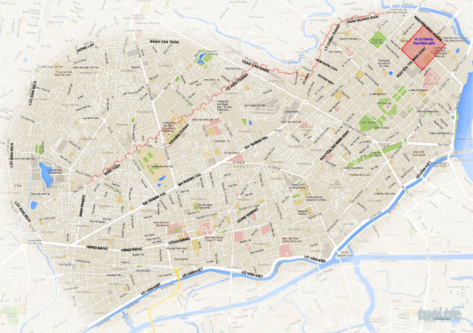
Like a truffle hog who’s picked up a scent I dug into the history of the earthwork. I found that the rampart itself has long since vanished, but you can still see its impact on the shape of the city. Lũy Bán Bích street isn’t where the eighteenth century defensive earthwork was actually situated; it’s simple named in it’s honour. The actual location was closer to the city centre, with Lý Chính Thắng and Trần Quang Khải streets today following the course laid out by the defensive structure (source).
One afternoon after finishing teaching, I went to up to Lý Chính Thắng street to see whether anything in the area might still look like a rampart, after all, I’ve found ramparts in Binh Dinh and Phu Yen provinces.
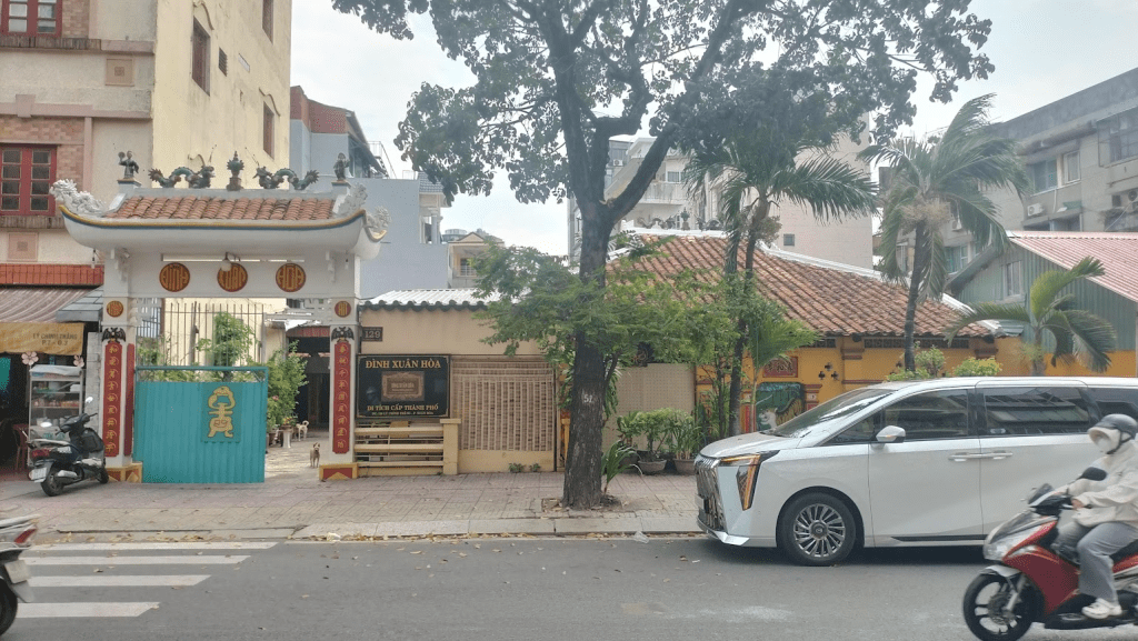
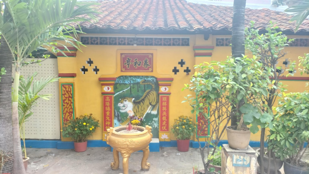
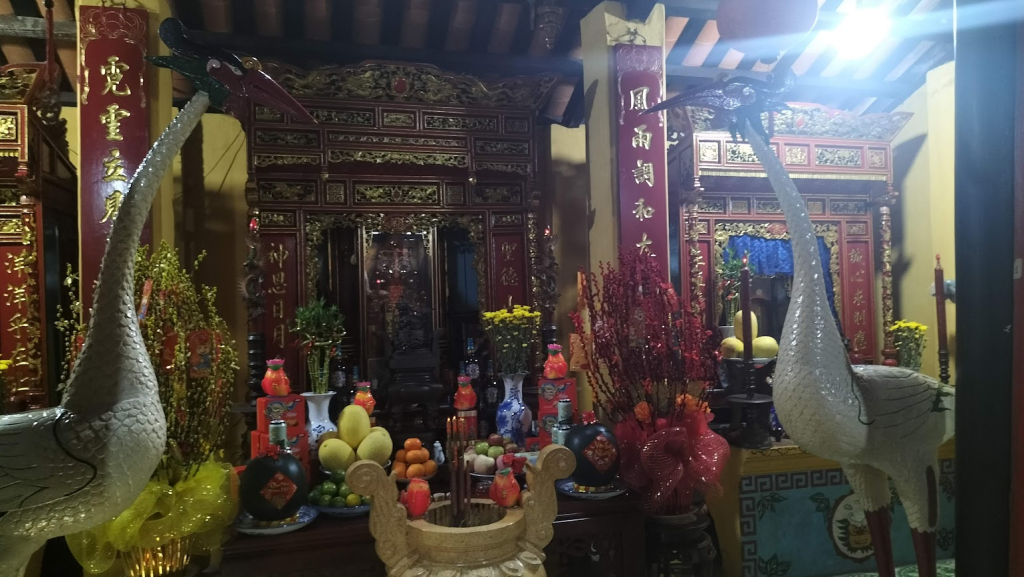
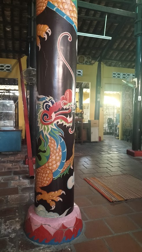
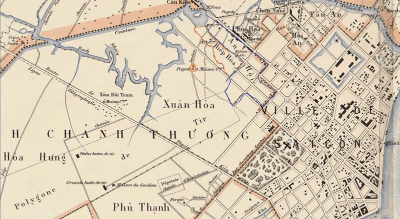
As I wandered down the street, wondering if it was on slightly raised ground or if it was my imagination, my eye was drawn to an old temple called Đình Xuân Hòa. It is a squat yellow building, the sort of Asian architecture that seems compressed under the weight of its terracotta-tiled roof. As I stood looking, a hunched elderly woman emerged and waved me inside with a smile. She seemed pleasantly surprised to discover that I could manage a little Vietnamese. She showed me around the incense-smoke-filled interior, where paintings of bucolic scenes hung beside statues of animals and golden Buddhas were surrounded by offerings. She explained that the đình was about three hundred years old, though the earliest written record I could find dates from 1852 (source), which is still impressively old for Saigon. Before I left she introduced me to the resident thầy (master), a serious grey-haired man. He disappeared briefly and returned to present me with a small bag of bananas to take home.
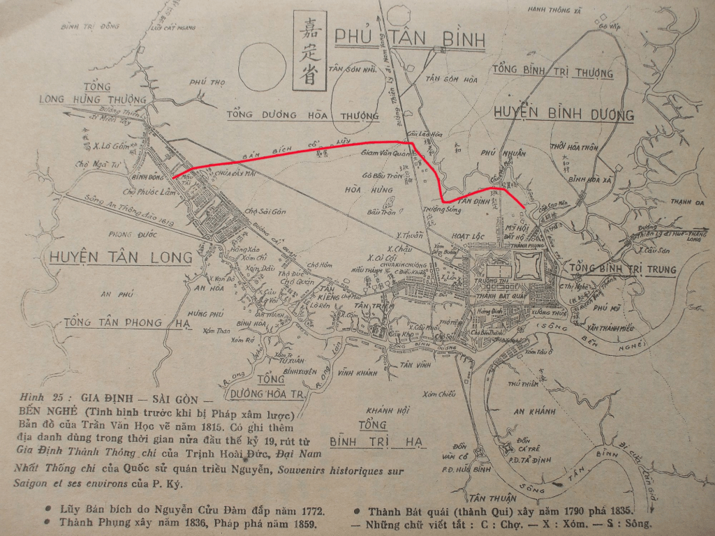
Leaving the temple I’m back on the street where the old rampart once ran. To understand why a rampart was built here, you have to go back to a time when the city was still a fledgling settlement in the wild frontier of Vietnam. In 1772, a general named Nguyễn Cửu Đàm, a second generation settler, made a name for himself by defeating the Siamese. To deter attacks on his hometown of Saigon, Nguyễn Cửu Đàm ordered the construction of a defensive system around the fledgling settlement. Creeks were dredged to form a partial moat and then closed by an earthen rampart. This is documented in the chronicle Đại Nam liệt truyện compiled in 1852.
“That summer (1772), Đàm advanced from the Tiền Giang River and decisively defeated the Siamese army in Phnom Penh. The Siamese army fled to Hà Tiên, then sued for peace. The situation in Cambodia was restored to peace. Đàm led his troops back and built the Tân Hoa rampart, 15 dặm* long and shaped like a crescent moon, surrounding the camp and blocking the land route to prevent any unforeseen events.” – Đại Nam liệt truyện
*: dặm is a historical unit of distance. One dặm was probably 576m at the time (source), so it gives the length of the rampart as 8.64km
Upon moving back to Saigon, I had assumed my history excursions would have to be put on hold. That was a disappointing thought because following up a historical lead has resulted in so many of my favourite adventures and human encounters, the sort that make life feel worthwhile. But history has a habit of always appearing in the most ordinary places. This time it was just the street name of my school. Following that thread led me on a small adventure that ended, as all good adventures should, with a story to tell and a bag of bananas in my hand.