What it’s like experiencing a typhoon in Vietnam

I’ve always been curious about the dramatic storms you see in films like cyclones and twisters. What is it like to experience one first hand? Well, I ended up being right at the epicenter of a tropical typhoon. Here’s my story.

Steve, a tall Englishman with cropped grey hair and the air of someone who’s seen it all, runs a small beachside resort of bamboo huts and a backpacker dorm just outside Quy Nhơn City, central Vietnam. We’d arranged that I’d come down to help out for a bit—hosting guests in exchange for a bunk, meals, and all the beer I can drink.

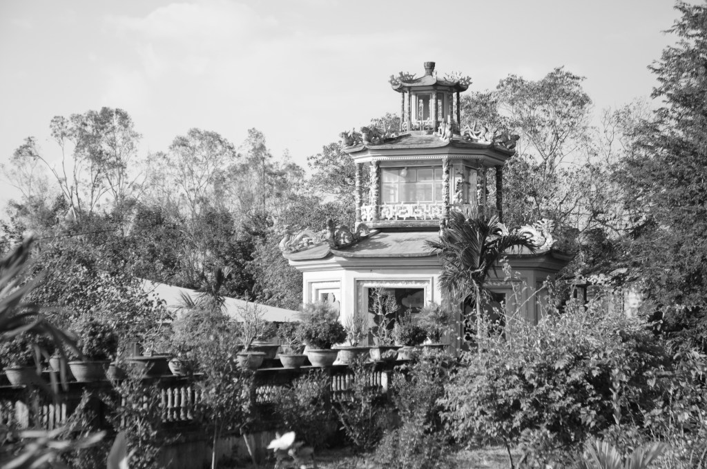
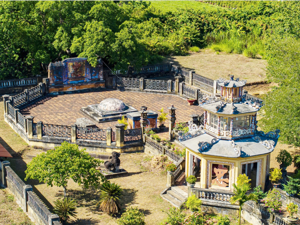
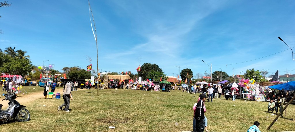
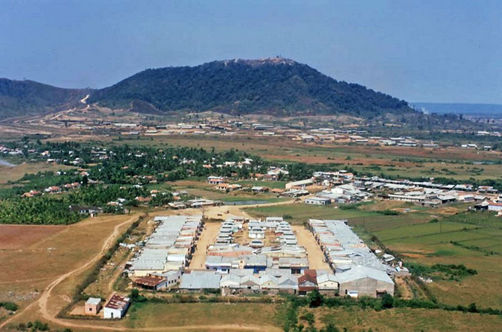
But when I arrived, there was a spanner in the works. Steve was fretting over the forecast. He’d been in Vietnam twelve years and had seen enough storms to know when one meant trouble. “It’s going to be the worst since 2017,” he told me. For me, this was a bit of an adventure but for him, his whole livelihood was at risk. The forecasts showed the storm would make landfall almost exactly here – Quy Nhơn was to be the epicenter.

He didn’t like having guests around in that kind of weather—too risky if something happened or needed to reach a hospital. He suggested I find a hotel in town. I took the hint and went on Wednesday, choosing somewhere a few streets back from the seafront (it seemed sensible).

At check-in, the staff warned me: There’s a storm coming.
I said I knew.
There will be no power tomorrow, they added.
That was fine by me.

That evening, I went to the supermarket to stock up on supplies. There was a buzz of urgency like going to the supermarket on Christmas Eve. The crisp and instant noodle aisles had been stripped bare. I needed things that wouldn’t require cooking or refrigeration—fruit, bottled water, chocolate, and a few packs of dried squid and “Peperami” for protein.

Afterwards, I stopped by 69 Pub, run by my friends Kevin and Trinh. There I bumped into one of the Pleiku old boys, and we drank late into the night. He was planning to drive back to the highlands the next morning to visit Kevin, and invited me along. But the idea of taking the infamous An Khê Pass in a typhoon didn’t appeal. Better to hunker down and wait it out.

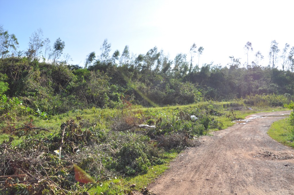
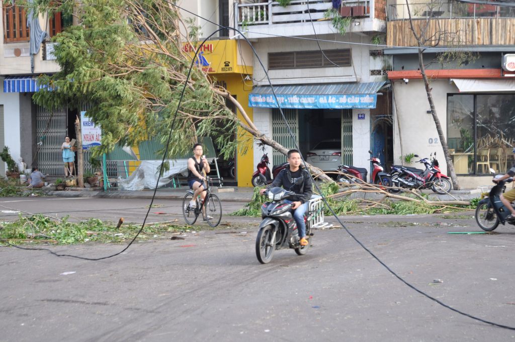
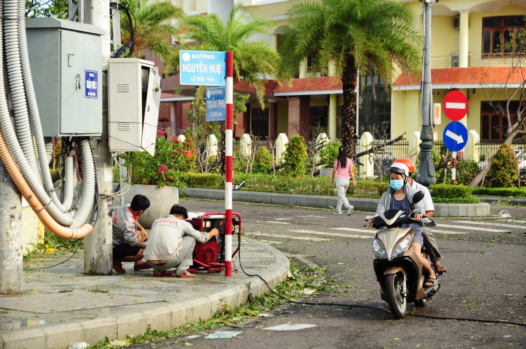
Outside, workers were busy cutting branches from trees and tying trunks to buildings. The news reported that 140 people had died when the same storm swept through the Philippines. From my hotel window, I looked out over a patchwork of tin roofs weighed down with a variety of things – tires, polystyrene crates, binbags full of water.

By eight in the morning, it looked like a normal rainy day outside. The wind was nothing alarming yet—just the usual “better to curl up with a book” kind of weather. The housekeepers knocked on my door. They were going home after finishing their round and handed me extra bottles of water and a fistful of instant coffee sachets.

By ten, the food stalls had all closed up. A few people still hurried along the pavements. I made a pot noodle in my room and was reminded of Saigon during the covid-19 lockdowns. I realise for the first time that ever since then, I’ve hated staying indoors. I always have to get out and go somewhere every day. Sometimes I hop from cafe to cafe all day long. I sit back on the bed and mentally prepare to stay put like back in lockdown.

By noon, the rain was slanting hard against the windows. The building groaned under the wind. The afternoon light was dim like midwinter, the clouds were heavy. There was still some traffic, even a few motorbikes out but no one was out on foot now. I ate snacks, read, and watched YouTube.

At five a friend in the Pleiku police called me to tell me that Quy Nhơn was planning to turn the power off soon. I decided to eat my second pot noodle while I still could but the power went before the kettle boiled. The city was plunged into the gloom of the fading light filtered through the storm. My first thought, “do I have enough phone battery?” The wind was now howling between the buildings, flinging debris across the street. It sounded like an approaching tube train that never arrived. A shop sign scraped along the road as if it had a mind of its own. I could feel the window pulsing under the pressure. Suddenly, a man walked past in shorts and flip-flops, no shirt – only in Vietnam! Bits of roofing came loose above me.

I watched as the building opposite, the one with binbags full of water as ballast. The bags were popping, emptying then flying up into the air as if being abducted by aliens.

At seven it all suddenly stopped. After hours of steady escalation, the silence felt unreal. I wondered if we were in the eye of the storm. I’m anxious to know if the storm will come back. Outside, people were out with torches, small coordinated gangs of men moving with purpose—they were quickly moving the large dangerous pieces of debris into basements.

When I opened the window, a strong smell hit me. It was part sea breeze, part earth after rain, and part something electric, like licking a 9 volt battery. Then the wind returned—as suddenly as it had stopped—I quickly shut the window. Down in the street, a single torchlight darted past, the point of light wobbling as a man sprinted across the wind.

I lay down alone in the darkness, the bed shaking as the whole building rattles with the wind. I thought of Steve at the coast, his huts facing the wind, and wondered how they were holding up.


I woke at six to stillness and clean blue skies. There was no power and no phone signal. I decided my lockdown was over. I slung my camera over my shoulder, then hesitated—was it crass to photograph the wreckage?

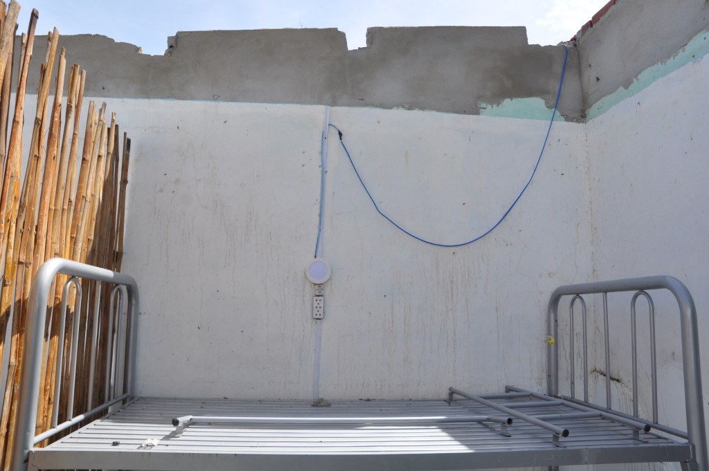
Like many modern hotels, mine had no guest stairwell, and with the lift dead, I took the outside fire escape to the lobby. The front door was barricaded with sofas and tied shut with rope, so I slipped out through the basement car park, ducking beneath a screen door which someone had bent just enough to get under.

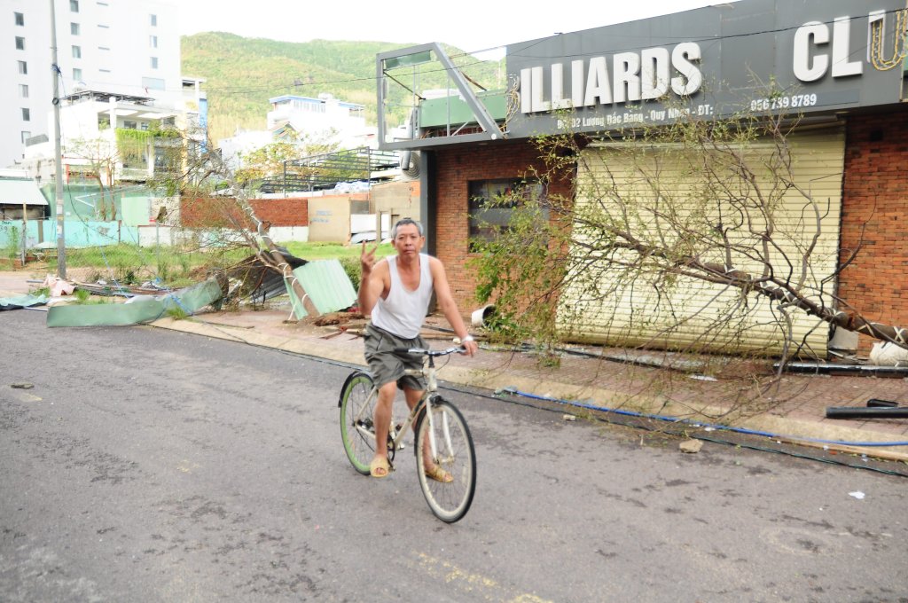
I needn’t’ve worried about the camera. If anything, they encouraged me. “Take a photo of that!” one man called, pointing to a billiards parlour reduced to rubble. Another insisted I take his portrait. This area has only hotels and restaurants so perhaps people felt no privacy was being invaded.

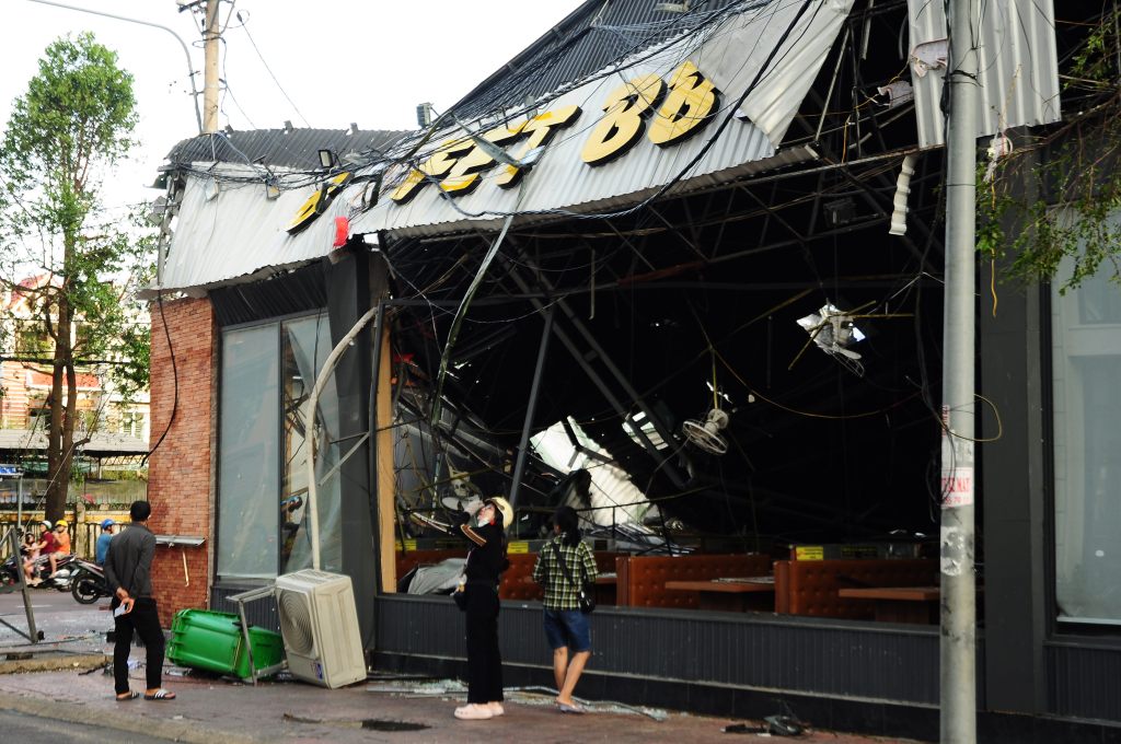
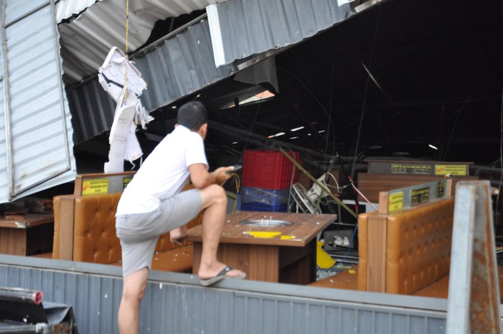
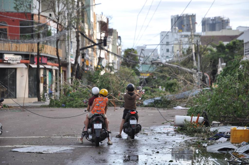
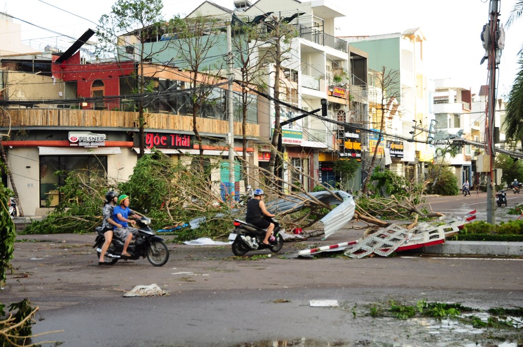
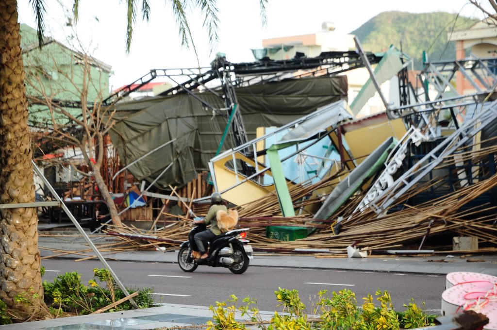
The street looked like a bomb hit. Several buildings had collapsed roofs, some are just piles of splintered wood so I can’t even tell what there were before. Many of the big hotels have windows smashed out. Street lights, trees and telegraph poles lay across the tarmac. Power cables dangled all over the road like vines in the jungle.

A group of university students ran past, laughing, clutching coconuts that must have blown from some public trees. Many of the men I passed were out inspecting the damage, hands on hips, giving me the same look that seemed to say, “Would you look at that.” There was a strange sense of camaraderie, as if we’d all survived something together.

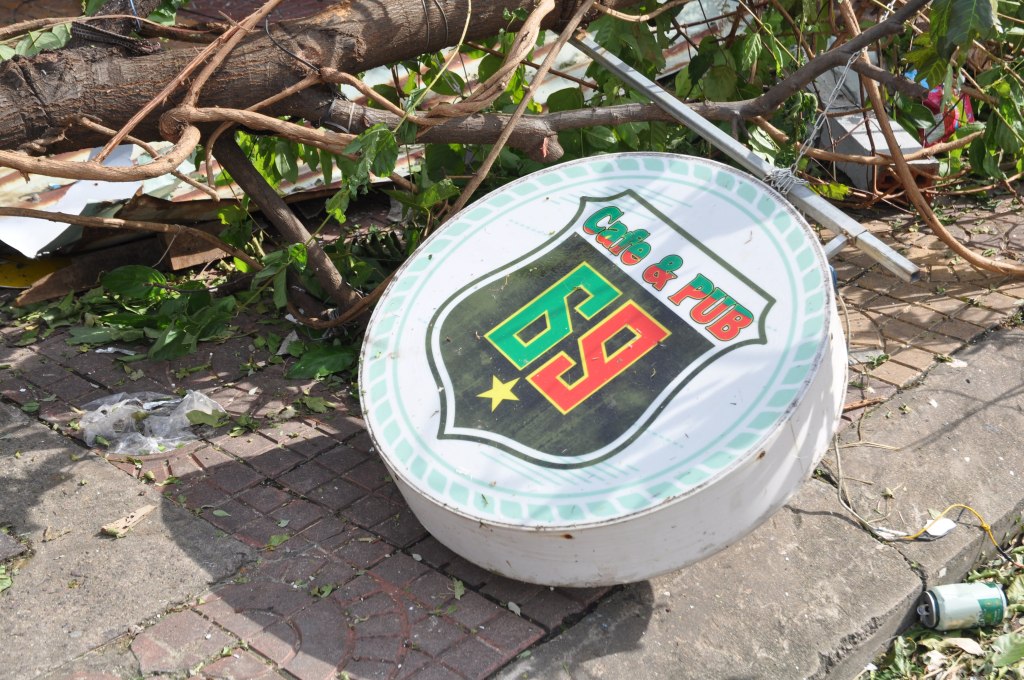
I wandered back down to 69 Pub, where I’d been drinking two days earlier, to see how it had fared. The front was unrecognisable: the sign’s letters had vanished, trees were down, and the air-conditioning unit dangled by its pipe. But the squat building with its rolling shutters looked largely intact from where I stood. It felt strange—two nights ago there was laughter and music, now it was just silent.

“Yeah dude… fuckin sucks,” Kevin texted back when I sent him a photo.

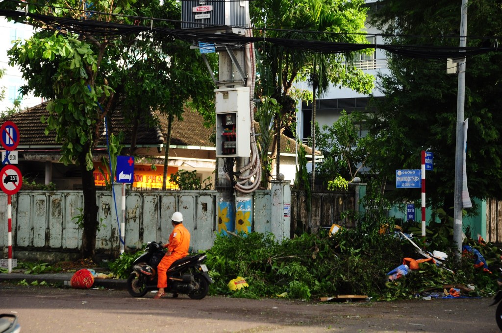
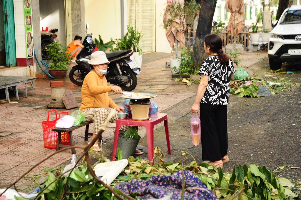
By seven, the city was alive with activity: shop-owners swept, some street cafés had open, an old lady was selling something fried for breakfast from a grill on the street. Sirens blared as police and ambulances went past at regular intervals. The army were clearing the hospital. Quy Nhơn was already piecing itself back together. I was amazed by the resilience of the people here.

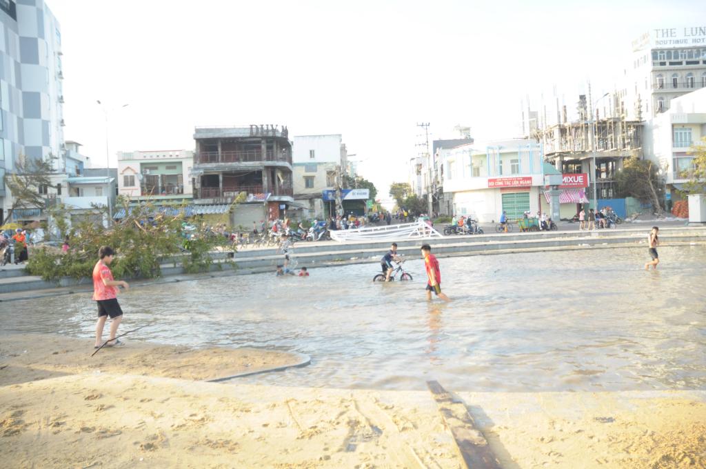
With schools closed, there are gangs of kids out enjoying the seafront. The road along the seafront has about a foot deep in sand making a brand new beach for them to play in as motorbikes gingerly drove by – the actual beach was covered in debris and litter. One of the parks along the promenade has filled with water making a temporary swimming pool, kids were splashing around having a whale of a time, some even have floats. It reminds me of the day we got sent home because of a storm when I was in secondary school in England. What frightened adults felt like adventure to us kids.

By late afternoon, electricity flickered back to life in some small parts of the city. Most of Quy Nhơn remained dark, though, lit only by the flow of mopeds. I found a different hotel with electricity and text Steve

“How’s it going?”

I get one word in response: “Catastrophe”.


The next morning, as I ate phở for breakfast, a convoy of huge military flatbed trucks thundered past — maybe twenty in all. Later, I saw them carting away fallen trees, street lamps, even heaps of sand to a builders’ yard outside town. I guessed that must have been the sand that turned the coast road into a beach.

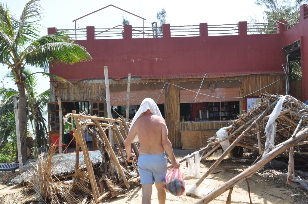
When the petrol stations reopened, I filled up and drove back to Steve’s resort. The first thing I saw was the staff dorm where I’d been sleeping. There was no roof. The Vietnamese staff were squatting outside the guest dorm, which was luckily undamaged.

“Was anybody hurt?” I asked.
“No… oh yes, Steve.”
“What happened?”
“He’s got a broken heart.”

I found Steve with a towel over his head, salvaging furniture from a roofless room. He told me I could consider myself officially dismissed from my volunteer role.

You can view more photos here: https://photos.app.goo.gl/tCNZ4c9YY2A1pegSA

The Elephant Dynasty of Buôn Đôn

I’m experimenting with a new format for my post where all the historical/geographic details will come at the end in appendices.

It was a quiet street in the early morning, almost empty except for a lone man leisurely passing by on an elephant. The great beast padded softly on the tarmac, surprisingly quiet for its size. The rider looked bored — just another Wednesday morning. Around them, the town stirred slowly: weathered wooden stilt houses, smoke drifting from cooking fires, the air already losing the night’s cool. This is Buôn Đôn which has long been a cultural crossroads. Not only Vietnamese, but the indigenous M’nông and Êđê call the town home, and there’s even a small yet significant Laotian community established since the late nineteenth century.

I hadn’t even planned to come to Buôn Đôn. I’d been on the road since dawn, making several stops along the way (including a midday dip in a waterfall). By the time I reached my intended destination — the Champa tower at Yang Prong — schoolchildren were spilling out of classrooms, meandering home on their bicycles and e-bikes. Both I and my moped were plastered in sunbaked mud after kilometre upon kilometre of dirt tracks through the sparse dry forest typical of the highlands.

The ancient temple stood in a pocket of untamed jungle, towering trees filtering shafts of light onto the red brickwork. It’s the last of its kind in the Central Highlands – standing strong and dignified like an elephant. At its base, sticks of incense burned beside candles and small offerings of fruit and bottled drinks, freshly left by locals. Soon after I arrived, a group of schoolchildren came to hangout. They asked the usual English learner questions — “What’s your name? Where are you from?” — then asked me to pose with them for a photo. The tower was worth the journey, but I’d driven an awfully long way, and the sky was already dimming. A glance at Google Maps showed “Buôn Đôn” was a town an hour’s drive south had some places to stay.

After waiting a quarter of an hour in the dark, the owner appeared on a moped with her daughter and unlocked a vacant hut for me. The attic-like single room had three beds, thin plank walls, and textiles in vaguely tribal patterns. You might call it glamping. The first place I’d tried to stay rejected me saying that didn’t host foreigners. I sat on the veranda eating instant noodles, listening to the night chorus of insects and frogs. It wasn’t the most comfortable night — the mattress was hard, and a pair of tree frogs kept launching themselves across the room with loud thuds — but I was too tired to care. So much for glamour.


The hoofprints, the smell of blood, the jawbone — all signs pointed to a ritual animal sacrifice. In Buôn Đôn, the old traditions die hard. Each grave is marked by a sarcophagus-like tomb, topped with a tin roof and flanked at the corners by carved animal figures. A headstone, often bearing a faded photograph, watches over a small wooden offering tray at the front. I counted at least four such graveyards scattered around the town. However, more impressive were the three large mausoleums, each with its own story to tell.

These mausoleums belong to three generations of leaders who held the title Elephant King from the mid 19th century until 2012. Their tombs are striking structures, built in the Lao style rare in Vietnam, with ornate stupa-like structure pointing towards the sky. There is no current Elephant king but their legacy lives on in Buôn Đôn’s enduring association with elephants. Several sites around town still keep elephants for visitors to see, though the days of elephant-back rides, races, and other activities have been stopped because they’re considered inhumane.

I’d set off the morning before hoping to learn about a Champa tower, but I’d also managed to stumble upon the legacy of a dynasty of elephant kings. It was a reminder that the Central Highlands still has secrets to be uncovered — if I ever get the chance.

Appendix A

Yang Prong Champa Tower

Although there are many archeological sites in the Central Highlands from the Champa kingdom, Yang Prong is the only complete Cham tower in the region (Google Maps Link for Yang Prong). It stands just outside the small town of Ea Rốk in north-west Đắk Lắk in a small patch of jungle shaded by tall trees. This contrasts with the Cham towers I’ve visited in Bình Định, which tend to stand exposed on bare hilltops. The canopy made the place cool and pleasant to sit on one of the benches for a while and quietly reflect. Yang Prong in Ede means the tower of the Great God, the god who controls the crops according to local custom.

The tower was built as a shrine to Shiva by King Jaya Simhavarman III (Chế Mân) in the late 13th century. Chế Mân is remembered as the Cham ruler who allied with Đại Việt to repel the Mongol invasion, and later married the Vietnamese princess Huyền Trân in exchange for the territories of Châu Ô and Châu Lý. The union is seen by many as marking the beginning of Champa’s decline.

Sources say the tower was once part of a citadel complex, similar to the one I wrote about at Hoàng Đế but much smaller (source). Fresh offerings of fruit, incense sticks, and candles suggest continuing local reverence. When I arrived at dusk, a group of children were hanging out after school. The site felt like a part of the fabric of the local community.

The Đắk Lắk provincial authorities have expressed interest in promoting tourism to the Yang Prong tower. In my opinion, the site could be enhanced with a path running along the riverbank, allowing visitors to better appreciate the landscape and setting of the monument.

Interestingly, to connect the Champa ruins to the topic of elephant kings, the stele of Drang Lai from 1435CE found at modern day Ayunpa speaks of “Close political ties between the lowlands and highlands led to the integration of the ‘Great king of the Montagnards’ within a territory called Madhyamagrāma, and the vassalage of Śrī Gajarāja (‘King of the Elephants’)” (source). Y Thu may have been aware of a long tradition of elephant kings when he took the title.

Appendix B

Y Thu K’Nul: Elephant King I

The oldest mausoleum in Buôn Đôn is to Y Thu K’Nul and was constructed in 1938. He is reported to have been 110 years old when he died. source, source

Y Thu K’Nul was a man of the M’nông peoples. He also had an affinity for the Lao people and adopted their style of dress. This is probably connected to the fact there was a budding Laos diaspora in the area at the time (source). In fact the name Buôn Đôn is said to be from Laos (ດອນ) meaning islands, for all the small islands in the area on the river (source).

He was supposedly given the title Khunjunob which according to Vietnamese sources means Rich and Noble Man. He was given this title in 1861 by the Siamese emperor upon delivering a white elephant. I can’t find any source for this that isn’t Vietnamese although Khun (ขุน) is Thai for chieftain.

In 1933 Emperor Bảo Đại visited Buon Ma Thuot where Y Thu arranged for the emperor to be greeted by 162 elephants lining the road. Several photographs survive of this event.

According to historical documents kept at Dak Lak Museum, in the 1900s, when Y Thu was over 70 years old, he stopped participating in elephant hunting, taming and trading and handed over his career to his son, R’leo K’Nu.

He is buried in a mausoleum in Buôn Đôn and his son R’leo K’Nu was later buried next to him. Google Maps Link

Appendix C

Y Prông Êban: Elephant King III AKA Ama Kong

Ama Kông (1910–2012), born Y Prông Êban, was the third and final generation of elephant kings succeeding R’leo K’Nu. His name is well known today partly because of a brand of herbal mens-health tea sold at almost all tourist destinations in Dak Lak. Over his lifetime, he reportedly caught 298 wild elephants.

He was recognised by Hồ Chí Minh for his contributions to the first indo-chine war.

His final hunt took place in 1996, after which he retired to train elephants for Yok Đôn National Park.

He died in 2012, said to be over a hundred years old. His tomb, built in the Lao style, is in the middle of Buôn Đôn. Google maps link.

Appendix D

White Elephants

While researching this article, I kept coming across white elephants. Ama Kong is reported to have captured 3 (source). Y Thu K’Nul also captured one which he gifted to the Vietnamese Emperor Bảo Đại (source).

Why do the sources mention about white elephants? Well owning white elephants is a symbol of royalty in south east asia. The tradition comes from Buddhism where white elephants are associated with Śakra, the ruler of the Trāyastriṃśa Heaven. They are so important that the Burmese-Siamese War of 1563–1564 was fought over white elephants.

I was surprised to learn white elephants are not actually white. They may be pink or have pink patches. In Thailand, white elephants are “graded” and lower grades are often rejected by the king.

According to the experience that Mr. Ama Kong passed on to his son, to distinguish white elephants from normal elephants, one can only look at their eyes and tusks. White elephants have blue eyes, and pink tusks. Herds containing white elephants are often very large, they are very gentle, and especially white elephants are always in the center. – on Khăm Phết Lào son of Ama Kong

Of course we have the idiom “white elephant” this is from the convention in Thailand where the king will give lower grade white elephants to people who have annoyed him. The sacred animals are not allowed to work but must be looked after at great expense to the owner.

Thành Hoàng Đế: Capital of Two Kingdoms

This blog post is about a visit I made to Hoàng Đế Citadel in Bình Định, South Vietnam. It’s a 40 minute drive from Quy Nhơn City.

The only respite from the harsh Bình Định sun was inside the tower, though the air inside reeked of guano. Besides, the ornamentation on its flank unnerved me, the crumbling brickwork seemed to form a huge skull.

The air was dry and dusty, the grass wilted, and the only movement came from a few cows and buffalo grazing by the rice paddies down at the foot of the hill. Insects buzzed in the bush. I scrunched up my eyes, scanning the countryside. From my vantage point I could see another tower on a rise about ten kilometres away, orange bricks standing tall through the hazy air. “Well, now I’ve seen it, I’ll have to visit that one too,” I thought. And so the afternoon went, the sun unrelenting as I scrambled up one hill after another, to get up close to the ancient towers that crowned them.

These solitary towers perched atop a lot of hills in the province are the remains of ancient Hindu temples built by the Champa Kingdom. Today, these towers stand among the last visible traces of the medieval kingdom and are iconic symbols in the minds of locals of the lost civilisation. But the towers are not the only traces left. Earlier that day, quite by accident, I had found something that made me see the Champa story in a whole new light.


My trip that spring had begun with a jaunt down to the seaside accompanied by Emma — an old friend, fellow Brit and wonderful mentor from my English teaching days in Pleiku. This time, she had journeyed from Kuwait to catch up with old faces and get some vitamin sea before heading back to England. We’d spent Tết together in the picturesque cove of Bãi Xép, near Quy Nhơn city. Fittingly for this story, the city was decked out in Champa-themed decorations for the Year of the Snake, blending local history with the Chinese zodiac. On New Year’s Eve, we ambled down to the beach to watch the fireworks bloom over the distant city dancing on the waves. Some village children dashed about with firecrackers, their shouts mingling with the bangs, maybe to summon luck for the year ahead.

Champathemed Tết decorations for the year of the snake. I thought the different take on the snake was really cool.

I didn’t fancy spending too long lounging by the sea. Fresh from a breakup, I wanted to keep my mind occupied. So while Emma stayed to enjoy the sandy beaches, I turned inland alone on a sort of personal pilgrimage. I set off towards the high altitude city of Pleiku on my trusty old 110cc Honda Blade — the farmers’ favourite — planning to stop anywhere that looked interesting along the way.

The first stop, just outside Quy Nhơn, was a pin on Google Maps that had caught my eye. But when I rolled up, it didn’t look like much — a small village snoozing away the hot national holiday; no tourists, no ticket booth, but thankfully no inflated holiday parking prices. The gate was modest, one might mistake it for a local pagoda. However, the pair of weathered elephant statues outside gave a hint that this village had an illustrious past. Because here, I later learned, had once been Chà Bàn citadel (sometimes called Đồ Bàn), the administrative heart of the Vijaya, Champa — and the place where the kingdom’s story came to an end.

I parked the moped and slipped in through a small open gate beside the main entrance. Inside, I found myself alone in a two-hectare grassy field, hemmed in by a wall of large orange stone slabs. A flagpole stood proud in the centre, flanked by a few pagoda-esque structures. It is the sort of place where you might want to stretch out on the grass under a tree with a flask of iced tea and a bánh mì and listen to the birds singing. So that’s exactly what I did (I’d had the foresight to buy a bánh mì Vietnamese sandwich on the road). Off to the east, perched on a low hill outside the tourist zone, I could see a Cham tower watching quietly over the empty field.

Only later did I learn that this tidy little visitor site is but a postage stamp compared to the original citadel. The ancient stronghold of Vijaya once sprawled across an area of more than three hundred hectares – nearly twice the size of Huế Citadel. A French archaeologist sketched it a century ago, American topographical maps caught it again during the war, and now, with the powers of satellite imagery, I’ve traced its rough outline on Google Earth. As it turns out, that Cham tower, not the flagpole, was the centre point of the original citadel. (source)

What struck me on my second visit was how big the rampart of the outer wall was. I’d totally missed it on my first visit because I’d made a B-line from the main road to the elephant statues but if you approach from the south you pass through a huge mound of earth that reminded me of the unrestored parts of Great Wall of China more than anything – trees growing on it, farms butting against it, roads cutting through it. I estimate the walls must have stood at least 6 meters tall.

Chà Bàn Citadel saw some of the highpoints in Champa history. For example in 1377, Trần Duệ Tông of Đại Việt led an army to attack Chà Bàn in retaliation for several devastating raids Vijaya had perpetrated against Hanoi. Vijaya’s king at the time R’chăm B’nga the Great set a trap for the emperor by feigning surrender only to ambush the Tran forces. In the fray, the Trần Emperor was killed by an arrow. (source)

Archaeological finds from the site tell other stories: local pottery fragments, roof tiles, and lion statues. A number of relics are now on display at the Bình Định Museum in Quy Nhơn, while a pair of dvarapalas (buddhist gate guardians) are enshrined at a nearby pagoda, venerated by the locals to this day and having many folk stories surrounding them. I went to see them on my second visit to the area and was amazed by how large they are, they are tall and weight 800kg are quite intimidating.

The citadel of Vijaya stood strong and proud as the capital city, right up until it didn’t. The chronicle: The Complete Annals of Đại Việt, records how during the reign of Vijaya king Maha Sajan (Trà Toàn), a campaign in 1471 led by mighty Vietnamese emperor Lê Thánh Tông sacked the citadel and in doing so brought Champa to its knees. The chronicle doesn’t skimp on the details and is a surprisingly good read. In the quote below you can see evidence of when the Citadel fell with some gory details.

On the 28th [March 19, 1471], the king besieged Chà Bàn citadel … 
On March 1 [March 22, 1471] ,Chà Bàn citadel was captured, more than 30,000 people were captured, more than 40,000 heads were cut off, Trà Toàn was captured alive, and the army returned.(Đại Việt sử ký toàn thư pp. 1383-1384)

yellow line: outline of Cha Ban citadel
blue area: outline of Hoang De citadel
source: Lê Đình Phụng, Di tích văn hóa Champa ở Bình Định (Champa Relics in Binh Dinh Province) (Hanoi: Nhà xuât bản khoa học xã hội, 2002).

But the story of this citadel doesn’t end with the fall of Champa. In the late 18th century, more than three centuries after Chà Bàn Citadel fell, it found itself swept up in the drama of the Tây Sơn Rebellion.

I’ve already talked in another post about my stop at Tây Sơn Thượng Đạo further up the road that same day. Well, the citadel here was the other major stage in this power struggle. By 1778, the underdog hero Nguyễn Nhạc had driven both the entrenched powers of the Lê and Nguyễn houses (no relation, just an unfortunately common surname) out of south-central Vietnam. After proclaiming himself Emperor Quang Trung—because why not—he needed a suitably imperial seat of power.

He chose the site of Chà Bàn for his center which then became known as Hoàng Đế Citadel. The interim time was a period of the area being opened up for Vietnamese people to move from the north and settle (source). There are records that prior, the Nguyễn clan had a fortification just 1km north of Chà Bàn’s outer wall, but when Nguyễn Nhạc defeated these forces he chose to relocate to the heard of the old Cham citadel. At the Quang Trung Museum, a mural shows an artist’s impression of the citadel during Tây Sơn rule.

After the defeat of Tây Sơn at the decisive naval battle of Thi Nai in 1801, the fortress fell to the Nguyễn forces the very next day. The name was changed to Binh Dinh meaning “subjugated”, this later became the name of the whole province until 2025.

The fortress was left to Võ Tánh and Ngô Tùng Châu to defend and they were soon besieged by Tay Son forces. The siege lasted 14 months. Food ran out and the defending army had to eat the horses and the elephants. Võ Tánh continued to hold out in order to keep the Tay Son army occupied to allow the emperor to conquer Hue. When it became clear there was no hope left, Ngô Tùng Châu committed suicide by drinking poison. After burying his friend and colleague, Võ Tánh locked himself in the Octagonal Pagoda then set it ablaze. Moved by their bravery, the Tay Son commander gave Võ Tánh a funeral and constructed a circular tomb. Both graves can still be seen in the citadel site. (source)

Finally in 1814 a more modern fort was built 5km source which stood as the administrative center of Binh Dinh province until 1930 when it was moved to Quy Nhon City and the age of citadels was over.


After my little picnic in the citadel (with all that history still unknown to me), I stood up, brushed off the bánh mì crumbs and ambled over to Cánh Tiên tower. There was a ticket booth this time but no ticket seller, so I did what any responsible citizen would do: I quietly slipped in through the fence and had a look around. Cham towers are always worth a visit. Their ornate, regal, and mystical forms are like something an explorer in a pith helmet would stumble upon in the jungle in a storybook — even if they do often smell of guano.

As I admired the tower, I noticed another tower perched on a distant hill. Then another. And another. That became the pattern for the rest of the afternoon: visit one tower, spot the next. By the time the sun began to dip, I’d visited four Cham towers and traced a good stretch of this region’s layered past before rolling on towards Tây Sơn District to learn what history could be learned there.

I’d set off to try and outrun heartbreak and found myself drawn to these ancient places. Why am I so captivated by the ruins? Perhaps it’s because their broken walls reflect something inside of me. Or perhaps it’s a feeling that if I can’t make sense of my own story, maybe I can at least trace the stories written on the hills of this wonderful country that I have come to call my home.

Further Reading

Launching my first game: WordStrike

A few weeks ago, I started tinkering with the idea of a classroom videogame as a way to get more use out of the arcade computer peripheral device I made last year. After trying it out in a few classes, I began to realise the game had potential so I recruited an artist to create proper graphics (the kids who playtested it really cared about visuals) and got some feedback from friends.

So today, I’m officially announcing the launch of WordStrike. It’s a fast-paced classroom game that’s now available for free on itch.io (link to my game). You can play it with just a normal keyboard.


The idea of the game is simple: each player flies their plane into the cloud that matches the correct word. What I think sets it apart is the competitive multiplayer element and how easy it is for teachers to customise the content to fit their exact lesson completely free of charge.

It has been a real joy to see kids genuinely enjoying a videogame I’d made. I hope other teachers can use it in their classes too. It’s designed to be easy for kids to learn and quick for teachers to set up. Two students can play at once, but you can also split the class into teams to keep everyone involved.

I’ve made videogames before for my own enjoyment, but this is the first one I’ve polished to this standard and felt happy to share with the world.

Tây Sơn Thượng Đạo – An Khê

One thing I love is visiting historic sites. Another thing I love is the central highlands of Vietnam. And it’s exactly those twin passions that brought me to the town of An Khê. There sits, right in the heart of this town, perched not far from the Ba River, the venerable site of Tây Sơn Thượng Đạo—a military training ground built about 250 years ago, now a national monument. During Tet holiday 2025 I came here to learn more.

Tây Sơn Thượng Đạo. source

At first glance, the place might be underwhelming, especially if you’ve seen old Vietnamese sites in Hue, Hanoi or Ninh Binh. There are a modest cluster of buildings in the familiar style of Vietnamese temples, a sun-scorched courtyard, a handful of statues and exhibits— and that’s about it. Yet being one of the few places with historic remnants in the highlands of Tay Nguyen makes it a rare treat for me to visit.

Today, An Khê is a toilet break on a road-trip between Pleiku and Quy Nhon cities. But in the mid-18th century, it was a wildwest frontier, just beyond the western edge of imperial control. Getting here from the lowlands meant ascending the An Khê Pass—a steep, winding climb that even now is spectacular but challenging. But it was precisely this location, at a strategic crossing of the Ba River and near tribal trade routes, that made An Khê ideal as a mountain fastness.


The site was founded by a man named Nguyễn Nhạc. Nguyễn Nhạc was born to a family of traders in Tây Sơn, Bình Định, working the wild frontier between lowland Vietnam and the highlands beyond. He likely knew An Khê well from his time bartering goods with the Bahnar and Jarai peoples—betel nuts for salt, forest goods for rice. In a country fractured between the Trịnh Lords in the north and the Nguyễn Lords in the south, he saw the hardship of ordinary people. Originally a tax collector, he grew into a kind of Vietnamese Robin Hood—redistributing wealth, resisting corruption, and gaining a following. The name Tây Sơn Thượng Đạo literally means the “high road” of the Tây Sơn, and Nguyễn Nhạc seems to have been a virtuous man by all accounts – taking the high road in more ways than one.

modern artists impression of Nguyen Nhac. by: “teapot”

When Nguyễn Nhạc and his brothers launched their armed uprising, An Khê was a strategic choice. Tucked behind the steep slopes of the An Khê Pass and straddling the vital crossing of the Ba River, it offered both protection and access. But location alone wasn’t enough. It was Nguyễn Nhạc’s leadership—his charisma, his deep roots in the region, and his trusted relationships with local highland tribes, especially the Bahnar—that made it possible to gather a unified rebel force here. Without that rare combination of vision and local knowledge, the rebellion might never have taken root in such a crucial place—let alone succeeded.

Nguyễn Nhạc and his brothers would go on to reshape Vietnam’s political landscape—defeating the southern Nguyễn Lords, toppling the northern Trịnh, and establishing the Tây Sơn Dynasty—a more stable chapter of Vietnam’s history.


These days, Tây Sơn Thượng Đạo draws visitors from all over the country, especially during the week long national holiday for Tet – Vietnamese New Year in spring. Tet holiday happened to be the time I had off work to visit this site and I was pleasantly surprised to find a fair set up in the field and a very festive atmosphere. Visitors could buy Bahnar food, local produce, and there was even a stand offering traditional Vietnamese calligraphy. To me, it was the perfect encapsulation of the areas diverse history.

It’s not hard to see why this site still resonates with the Vietnamese people. The people rising up to express their displeasure with the running of the country is a recuring theme in the history of Vietnam as much as anywhere – and of course the most recent time that happened is still very much in living memory. In that way, the spirit of Tây Sơn lives on.

Whether you’re a history lover, a curious traveler, or someone looking to get away from the more famous tourist sites — I suggest you stop in An Khê. Walk the grounds where a rebellion once stirred. Cross the Ba River where traders and rebels once passed. Stand where Nguyễn Nhạc trained his troops who would change the history of the nation forever.

Long Weekend Over the Border

With my VUS campus still very new when I joined two years ago, it’s been tough finding time to get away from the six-day workweeks. But I finally managed to stash a few overtime hours, and so I decided to do something different: I crossed the border from Gia Lai, Vietnam, into Ratanakiri Province, Cambodia. It’s a short trip, geographically speaking—just seventy miles—but one that feels significant. Ever since moving to Pleiku I’ve looked westward and wanted to cross the border into Cambodia from here. I have actually visited once before, during COVID, but that involved a flight to Phnom Penh and a painfully long coach ride north. This time was blissfully simpler: a three-and-a-half-hour VIP minibus ride from Pleiku City to Banlung City, with a smooth border crossing along the way. Besides crossing the border here somehow feels more significant.

I might be the first non-ASEAN passport holder among my Pleiku acquaintances to try this route. Everyone was interested in how it would go. I half-expected to be turned away at the border, but for 300,000 VND, the Vietnamese company’s minibus whisked me to the crossing in under two hours. We arrived to find plenty lorries carrying produce but few other travelers. An almost comically empty duty-free shop beckoned on the Vietnamese side, and an equally quiet visa office greeted me on the Cambodian side. A quick form, a $30 USD visa fee, and we were off again, arriving in Banlung ahead of schedule.

The border gate between Vietnam and Cambodia near Pleiku

Despite its remote location, Banlung welcomes travelers with an infrastructure that suggests it’s not quite the undiscovered gem visitors like to think. I meet plenty of tourists here—far more than in Pleiku—who insist they’re “avoiding tourists,” which makes me smile inwardly. Banlung’s tourism industry is quite developed, with a wide selection of tour-guides, homestays, and restaurants that cater to English speakers. It’s true that it’s a good place for anyone wanting to dodge the thronging crowds of Siem Reap or Hoi An, but let’s be honest—it’s not exactly an undiscovered frontier. I’ve learned that if you truly avoid tourists, you also avoid the amenities that make travel fun. I’ve been to small towns with zero tourism, and trust me, they can be pretty dull when you’re craving a decent meal or a comfortable bed, especially if you don’t speak the language.

One thing that really surprises me about Ratanakiri is its unexpectedly fancy supermarket called Setra—much nicer than anything I’ve seen in central Vietnam. My guess is it’s here for Chinese workers in the area, but its shelves boast all sorts of international goodies, including HP Sauce! Naturally, I stocked up on herbs, sauces, and a variety of beers from Thailand and Laos to share with my homestay hosts.

Speaking of which, I’m staying at a homestay run by the Tampuan, an indigenous Bahnaric-speaking group. I even catch a few words that sound suspiciously like Jrai, my second language in Pleiku. The homestay is listed on Booking.com and Couchsurfing; you can either pay for your room or work in exchange for it. We hadn’t agreed anything in advance but I ended up not paying in cash—I helped with light chores and used my laptop to design them a menu, assist Yok (one of the hosts) with his English CV, and create a collage of past guests for the wall. I’m no graphic designer, but knowing how to use Canva feels like a superpower out here. It makes me realize how many skills we take for granted—tools that seem trivial to us but can be game-changing in a place like this where few people even have their own PC or laptop.

Over dinner one night, Yok shares a story that gets everyone laughing. It’s about a Khmer man who marries a mountain girl and takes her to his town. The attitude definately reminds me of some people I know in Pleiku. Here is the full story.

Once a Khmer man married a mountain girl and took her back to his town. She was so excited by everything there that they didn’t have in her small village. He took her to the amusement park and she had childish joy going on all the rides.

When she was on a big swing her husband was waiting on the ground. To his horror, he saw that her underpants were visible under her skirt. When she got off the ride he said to her “Do not do that again, I don’t want people seeing your underwear!”. The girl smiled and was submissive to her husbands wishes as she had been taught a good girl should be.

The husband was satisfied and went to buy them both ice-cream but when he returned, he saw his wife was back on the same swing. He shouted and gesticulated madly. He ran and hit the emergency stop on the ride. The wife came down still smiling and asked “what’s the matter husband?”

“I told you not to go on that ride again because I don’t want people to see your underwear!” yelled the husband.

“Oh don’t worry darling husband, before I went on the ride, I took off my underwear!”

I really enjoy spending time in Ratanakiri. The sun here seems to shine at a different angle, bathing the landscape—and my mood—in an amber glow. It’s not just physical warmth; it’s an invitation to consider new possibilities. Maybe I’ll move here. Maybe I’ll open a restaurant or become a YouTuber. Or maybe I’ll return to Pleiku and get back to the daily grind; after all, there’s plenty waiting for me there, too.

Ultimately, it’s nice to step away from routine, cross a border, and remember that the world is out there, bigger than my usual bubble. The tourists I meet remind me that we each bring our own lens to new places, shaping how we see them—and how they see us. And as Yok’s story proves, sometimes the best thing you can do is step back, realize you’re taking yourself a bit too seriously, and share a good laugh.

Disneyland & The Golf Course: A Tour of Wartime An Khê

An Khe, 1971. View of the Ba Bridge from the north. On the left is the old French army base and airfield, later run by the American military and today by the Vietnamese army.

This post is about An Khê which is a town 70km east of Pleiku via the Mang Yang pass and 55km west of Quy Nhon via the An Khê pass. Situated between these two difficult mountain passes, the town has always been an important gateway to the insulated highland interior of Gia Lai and Kontum. It was of strategic importance during the Vijayapura Champa kingdom (11th-15th century) and it’s location was used to the advantage of the Tây Sơn uprising in 1771.

The town’s role as a staging ground for military operations continued into the French colonial era and the American Vietnam War when An Khê took on a unique identity. Amid the conflict, this highland town became the home to the unusually named places of “Disneyland East,” and “The Golf Course,”. During Tet holiday, I made a stop in An Khê to learn more.

Camp Radcliff and the Origins of “The Golf Course”

Wright [Brig. Gen. John M. Wright Jr.] pointed across the dirt airstrip where a day earlier we had landed in C-130s. “Triple-canopy jungle,” he said. “Big trees about 200 feet high. Then secondary growth up to about 80 feet. Under that, bamboo, thorn thickets, shrubs, and vines. And beneath all that is grass—turf. If we could magically pluck out all that foliage, it would look like a golf course…“If we scrape away the jungle with bulldozers, in a month we’ll have a giant dust bowl. That dust will be sucked into helicopter engines and turbines. This is the end of the longest supply line in the world. Every turbine blade, air filter, every fuse—every spare part—has to travel 12,000 miles. If our heliport is a dust bowl, we’ll wear out our ships faster than we can fix them. “So we’ll create a golf course. Chop down the trees, pull out the bushes and cut the bamboo, elephant grass, and the wait-a-minute vines—but leave the turf. – Marvin J. Wolf

In 1965 the US army established Camp Radcliffe at An Khe. The helicopter landing strip there got the nickname the golf course due to the grass. Although there never really was a golf course, it’s a strange word to see associated with 1960s Gia Lai (despite several attempts in recent years, Gia Lai still does not have any golf courses as of 2025).

Click here to watch a video of An Khe from 1966

helicopters on An Khe “golf course”
Watching a local Bahnar lady doing some traditional weaving

“Disneyland”

Nowhere was the shock of massive encampment greater in Viet Nam than in the sleepy little town of An Khe in the barren Central Highlands. Late last summer, 21,000 troopers of the U.S. 1st Cavalry (Airmobile) set up tents and helipads near An Khe. Prostitutes and profiteers swarmed into the town; prices for everything from beef to beer soared, as did the incidence of disease among the Americans. Dysentery and other intestinal diseases multiplied fourfold within four months; venereal disease soon afflicted nearly a third of the G.I.s.

It was the Vietnamese village elders who came up with a solution, which Kinnard reluctantly accepted as the best among unhappy alternatives: the first brothel quarter built exclusively for American soldiers in Viet Nam. Half finished, An Khe Plaza, as the sign at the M.P. gatehouse declares, or “Disneyland,” as the G.I.s call it, is a 25-acre sprawl of “boum-boum parlors” built of concrete blocks and surrounded by coils of concertina barbed wire. Each parlor consists of a bar with eight cubicles opening off the back. Eventually there will be 40 parlors, bearing such rubrics as Paradise, Caravelle, Golden Hind, Hill Billy, Washington and the Moderate Tearoom.

 The price of a “short time” varies with the demand from $2.50 to $5 and inevitably has produced grumbling. “General Kinnard ought to put his foot down,” complained one cavalryman last week. “Five bucks is too high. He oughta make three bucks the standard price.” The plaint is, of course, misdirected. An Khe Plaza is a creation of the Vietnamese and run by the Vietnamese, albeit for Americans.

Vietnamese girls who want to work in Disneyland must obtain a special entertainer’s card and visit An Khe’s clinic once a week for a medical examination by Vietnamese doctors and a U.S.-provided shot of a long-lasting penicillin-type drug to suppress disease. Forced to choose between morality and the morale of their men, the division’s officers are clearly troubled by Disneyland. But, as one colonel explained, “We wanted to get the greatest good for our men with the least harm.” For visitors to An Khe, even clerics and chaplains, Disneyland is as hard to condemn as it is to condone. In that respect, it is not unlike war itself, of which Disneylands—and far worse—are an inevitable accompaniment.

Time magazine 1966

(source) Disneyland East! Here is one of the bars in Sin City. All the bars looked pretty much the same from the front. Most of them were named after U.S. cities or states. I’m sure there was a California Bar, a Texas Bar, a Chicago Bar, a little bit of home. There was an M.P. checkpoint as you entered the compound. As I remember you needed a pass, although in our case, we were brought in by the truckload, and I’m not sure I showed a pass, I think we only had like two or three hours before the trucks would pick us up. If we stayed somewhat sober, and in uniform, the M.P.’s wouldn’t bother us. One night later in my tour my Civic Action team snuck into An khe, and spent the night in “Disneyland East”, even though town was off limits, after a sapper attack at Radcliff. A very successful attack, destroying a bunch of choppers. The Golden Hind is where we stayed, with our 3/4 ton truck parked in the little alley next to it, so the MP’s wouldn’t see it. You will see the Golden Hind was mentioned in this Time magazine story. https://content.time.com/…/art…/0,33009,901833-2,00.html 
Disneyland, 1967
Disneyland in the foreground and Hon Cong mountain behind

An Khê Today

An Khe is one of the largest towns in Gia Lai outside of Pleiku. It might seen sleepy by most people’s standards but I had a great time here for a few days with some locals and some foreign English teachers.

Although I couldn’t get anywhere near the golf course because it’s a military area, I did go to where I believe disneyland used to be, there is no sign of it’s sorded past but a local cafe owner did give me a free coffee.

Where I believe the entrance to disneyland was.
Bahnar food in An Khe, yummy!
View of An Khe town from my hike up Hon Cong mountain
Ba Bridge today, view from my hotel, Hon Cong mountain behind

links

Pleiku Prison

The well-known travel guide Rough Guides has this to say about Pleiku:

Though it’s not terribly easy on the eye, the regional capital of Pleiku possesses a carefree air quite in keeping with its far-flung location. The city was wrecked during the war, and so little of it was left standing that a near-total reconstruction was required when hostilities ceased. (source as of 08/01/2024)

This comment irritates me because it’s clear the author didn’t research properly. Pleiku wasn’t destroyed by the war—it was built by the war. The city expanded dramatically to meet wartime needs. Before the war, Pleiku was little more than a few bungalows and French administrative buildings. Contrary to Rough Guides‘ claim, many of these original buildings still stand today (source). It seems the writer visited, spent one night, found the city wasn’t Hoi An, and made assumptions based on a quick impression. However, for those who know where to look, some prewar remnants can be seen.

One such piece of history is Pleiku Prison, a site worth visiting if you’re interested in the countries past. Built around 1925, the prison housed both unruly indigenous peoples and political prisoners. The complex was surrounded by 3-meter-high walls and layers of barbed wire. Today, only one of the original buildings remains intact – but with it’s cramped, gloom cells – it’s a sobering glimpse into the past.

During the Second Indochina War, There was also a separate POW camp, where uniformed combatants were held, while civilian dissidents with suspected communist sympathies were imprisoned in the inner-city jail. It is claimed that after the Tet offensive of 1968 the prison help 800 captives. On March 15, 1975 the South Vietnamese were in a hasty retreat from Pleiku and the prisoners managed to break out of the prison prior to the arrival of the North Vietnamese army.

Unfortunately, I’m unable to give any other perspective on the prison because I’ve never been able to find any French or American records other than it being marked on the city map. I also can’t find any old photos. If you have any sources, please let me know.

Visiting Pleiku Prison is free. The main gate is typically locked and entry is via a smaller gate just at the top corner of the site. Today, there is a monument dedicated to the prisoners in the forecourt, commemorating their hardships and escape. In the Gia Lai province museum you can find a handkerchief which embroidered by Pham Kim Cuc during her time in Pleiku prison from 1968-1972 (source).

Key: 13 – civil guard camp, 22 prison. Many of the surrounding roads no longer exist but the red road north of the guard camp is now Hung Vuong and the modern route of Thống Nhất street can be seen going around the prison to the east. The long building which is currently a museum can clearly be seen, the + shaped building north of it remains as a ruin.

Christmas In Wartime Gia Lai

“Christmas, 1967”

The sand bags look the same:
a dismal green-grey bag leaks red clay
upon the bags below. Outside the perimeter,
children pick though the garbage,
thrown out waste of a thousand men.
Christmas in Pleiku, 1967, war fills
the surrounding hills. Across the valley
we see cloud puffs of artillery and

at night red, green, amber flares dangle,
shining bright beneath white parachutes
displays in sound and light rivaling the staged events of a thousand
towns across the “world” on New Year’s Day.
But this is Christmas: a time of truce.

Palmer Hall – source

U.S. Army men drinking rice wine from urns as they celebrate Christmas with the Montagnards. December 24, 1966
A war zone couldn’t keep Santa from his appointed rounds – Cheo Reo – Christmas 1971
Chris Towne
Maxmilian Kersthold, a U.S. Navy engineer stationed near Pleiku, plays Santa Claus, delivering gifts on Christmas Eve to Montagnard women and children in Mang Yang, a remote area of the Central Highlands, Dec. 24, 1965. | Associated Press
a parish in Pleiku (1967-69) Photo by Schneider (link)

The Battle of Plei Ring

The dirt road gave way abruptly to a stretch of wet concrete drying under the sun. Nearby, men were clearing up after a days work. A glance at Google Maps suggested I was only 1.5 kilometers from my destination, so I decided to park my moped on the verge and began walking.

From behind a hedge, an old woman called out, “Where are you going?”

“Plei Ring,” I answered.

She shook her head. “Plei Ring’s been under the lake for years. The road only leads to the water.” I replied that I think there is a monument there. “There’s no such monument” she said.

Her words lingered in my mind as I made my way forward, determined to find what I’d come for. While researching for my blog I came across the Battle of Plei Ring. I initially found references only in Vietnamese sources and found out there was a stele erected in the area to commemorate it – that’s where I was headed now. At first, I thought western records of the battle were nonexistent. It wasn’t until I closely studied old maps that I realized the discrepancy: where Vietnamese sources spell it Plei Ring, western accounts use Plei Rinh. This subtle difference highlights the care required when researching history so as not to miss important sources.

The Battle of Plei Ring involved one of the most formidable units of the French forces in the First Indochina War: Group Mobile 100 (GM100). Its core consisted of battle-hardened veterans from Korea, renowned for their valor in battles like Chipyong-ni, Wonju, and Arrowhead Ridge. The unit was bolstered by indochina troups in a process the french weirdly called « jaunissant ». After the Korean cease-fire in July 1953, this elite force was transferred to Indochina and formally reorganized as Group Mobile 100 on November 15, 1953. The G.M.s were designed as self-sustaining motorized regimental task force unit modelled on the U.S. Army’s World War II regimental combat teams. The G.M.s typically consisted of three infantry battalions with one artillery battalion, along with elements of light armor or tanks, engineer, signal and medical assets, totaling 3,000–3,500 soldiers

While up north things were heating up at Điện Biên Phủ, this veteran unit was tasked with securing strategic locations in the Central Highlands, after being battered around by the Viet Minh from Dak To down to Dak Doa, they moved to dig in at Plei Ring in the Ayun Valley, which was on what the French referred to as the “Pleiku-Ban Me Thot axis”.

The Ayun Valley is a striking contrast to the otherwise flat terrain of the Pleiku Plateau. From the ground, the plateau appears unbroken until the valley suddenly reveals itself—a vast, hidden expanse carved into the land. I was unaware of its existence during my first years in Pleiku until studying detailed 1:50,000 maps revealed the contours of this dramatic feature. Its natural concealment, reminding me of a ha-ha, probably made it an ideal approach for Vietnamese troops to advance undetected, likely influencing the strategic placement of the Plei Ring outpost.

“At that time, my unit operated in the southwest of Pleiku town, but we often marched through Ring village… Plei Ring post was located in the middle of a fairly flat valley. The post was triangular in shape, surrounded by sparse barbed wire fences, thatched roofs, about 15m in height, and they added patrols and guards. Many of my comrades on the march unfortunately died here.” – Ngô Thành (source)

On March 21, 1954, the Viet Minh’s 803rd Regiment launched a surprise attack on GM100 at Plei Ring. Employing rapid and decisive tactics, they overwhelmed the French garrison in just two hours. This victory not only disrupted the French defenses in the region but also boosted the morale of Viet Minh forces across other theaters of the war.

The French reported over 250 casualties, with the Vietnamese claiming to have neutralized nearly 1,000 enemy soldiers and destroyed more than 200 vehicles. Though figures vary, the significance of the Viet Minh victory is undeniable. It disrupted French control in the area and dealt a blow to their morale during a critical phase of the war. The GM100 would retreat to Pleiku and later move to An Khe setting the stage for their ultimate downfall at the (in)famous battle of Mang Yang pass.

Today, the site of Plei Ring village itself lies beneath the waters of Ayun Hạ Lake, created by the Ayun Hạ Dam in the 1990s. A small commemorative stele near the lake honors the sacrifices made. As I followed the newly paved road called “the French pass” into what was once the fertile Ayun Valley, now transformed into a reservoir, I imagined the events that unfolded here decades ago—the place is now makes a good location for a peaceful hike in the native dipterocarp forest.

Plei Ring Victory Site Relic

The Plei Ring victory site belongs to the old Ring village, now the Ayun Ha reservoir area, Ring village, HBong commune, Chu Se district, Gia Lai province.

After Kon Tum fell, the French colonialists concentrated their forces to strengthen the defense of the Central Highlands, especially in and around Pleiku town with 9 battalions, including Mobile Regiment 100 (abbreviated as GM.100). At the end of 1949, they spread rumors to stir up public opinion, combined with consolidating the fortifications of Dak Bot station, establishing Kon Thup, Plei Ring, and Plei Tau stations as support points; in mid-1950, they strongly promoted the concentration of people in clusters near the station and traffic routes for easier control.

Carrying out orders from Inter-Zone V, Regiment 803 assigned Company 6 of Battalion 59 to attack Plei Ring post. The remaining force of the battalion acted as reserve, Battalion 39 was tasked with attacking the newly reinforced Euro-African company that was temporarily camping outside.

With the strategy of quick attack and rapid development, not giving the enemy time to react; after nearly 2 hours of fighting (from 2:30 a.m. to about 4:00 a.m. on March 21, 1954), our army eliminated more than 900 enemies from the battle, 20 vehicles were destroyed, 200 vehicles and artillery were severely damaged. On our side, 36 comrades heroically sacrificed themselves.

The Plei Ring victory of the 803rd Regiment, although not a large force, caused heavy losses in manpower and weapons and dealt a heavy blow to the enemy’s will to stay awake, creating a turning point on the Central Highlands battlefield. This was the premise for the 96th Regiment to wipe out the 100th Mobile Division at Dak Po in an ambush, threatening the enemy on the entire battlefield of Military Region 5; contributing to reducing and destroying the enemy on the spot, preventing them from supporting the main battlefields, especially the Northern Delta and Dien Bien Phu.

The relic “Plei Ring Victory Site” was ranked by the People’s Committee of Gia Lai province according to Decision No. 327/QD-UBND dated March 20, 2020. – engraving on the stele

Today, Ayun Hạ Lake covers what was once the village of Plei Ring, hiding its stories beneath the water. While the dam and reservoir serve the needs of modern life—powering homes, irrigating fields, and supporting livelihoods—they also submerge the traces of a history. The past may be buried under the water, but the stories are floating around to be found by those who look.

sources

Design a site like this with WordPress.com
Get started