There’s something oddly nostalgic about taking a drive I used to hate. My weekly 6am drive to Đắk Đoa once felt like a chore, but over time, the small town grew on me. I started to appreciate its quiet charm—exploring its cozy cafés, like one with tiny tiled-roof huts and hammocks, or wandering through the pine forest between classes. Occasionally, I’d take scenic detours from Pleiku, winding through rubber plantations, stilt houses, and ethnic villages. Since changing jobs, I no longer make this trip for work, this time I’m heading back to Đắk Đoa for a special event.
The small town of Đắk Đoa is known for its pink grass, nhět rơmuay in Bahnar (possible a species of red top, I’ve not got a proper scientific ID), a seasonal phenomenon that blankets the open fields. You could say it puts the sleepy town on the map, in fact I once did have a tourist map of Gia Lai that listed “pink grass” as Đắk Đoa’s only attraction.
Today, Monday—my precious day off—the pink grass was calling me back to Đắk Đoa. Held in late November, right after the more famous Chu Dang Ya Flower Festival, the Pink Grass Festival showcases the town’s unique natural beauty alongside its rich cultural traditions and strong sense of community. I’d never been before, but when a local friend invited me to check it out, I couldn’t resist.
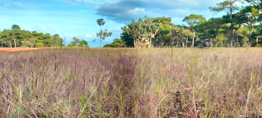
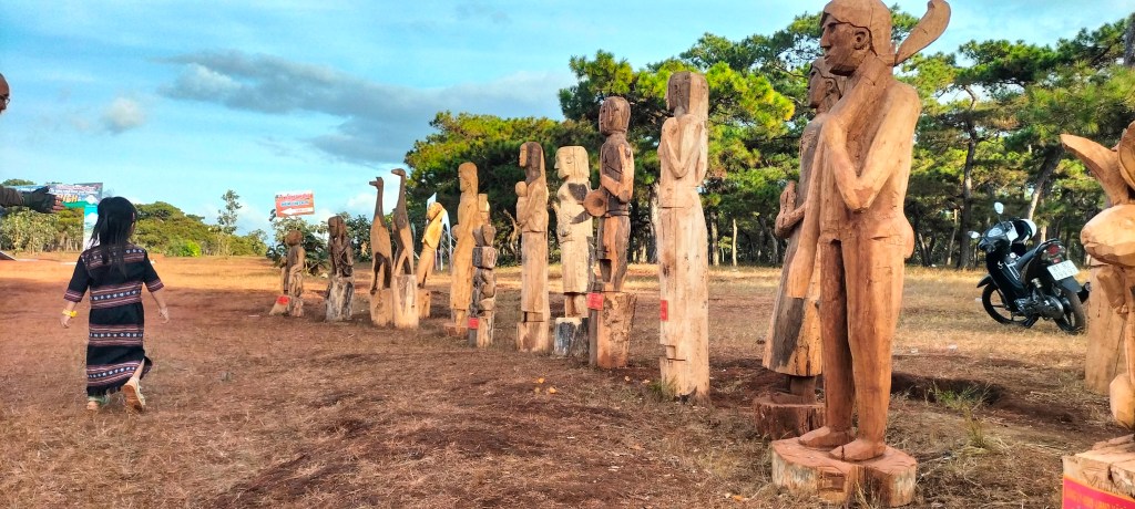
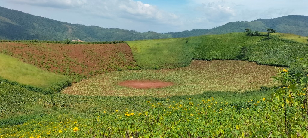
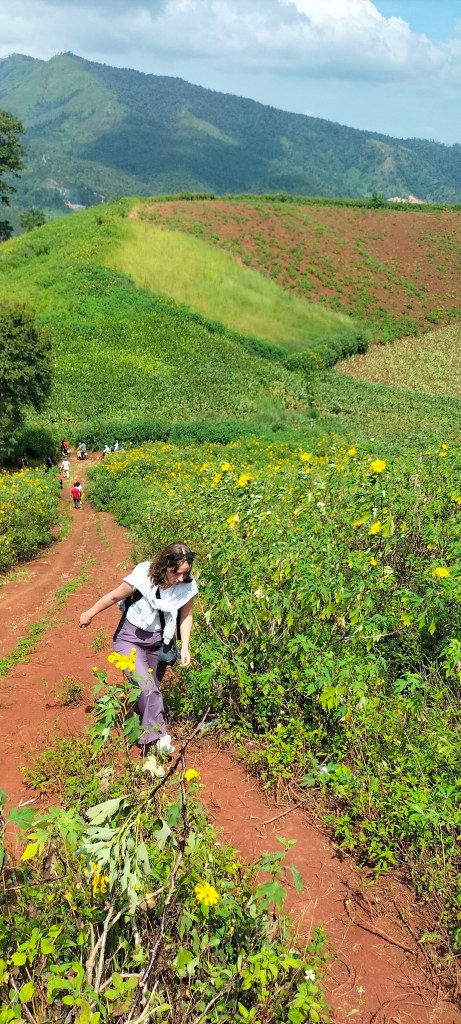
I arrived at the small festival in amongst the pine forest south of the town and parked my bike, noticing a few curious stares as I stepped into the field. The sun was shining brightly, casting a warm, golden glow over everything, while little puffs of cloud drifted lazily across the sky. The air was clear and crisp, not too hot—just perfect T-shirt weather with a light breeze keeping things comfortable. The first thing that struck me was the grass—not quite the vibrant pink from the heavily photoshopped images online. Instead, it was a desaturated reddish-purple, having browsed some colour palettes online I’d now describe it as “Antique Fuchsia.” Subtle and not unpleasant, the color gave the landscape a dreamy sheen, far more refined than the photos suggest.
unedited photo of the “pink” grass
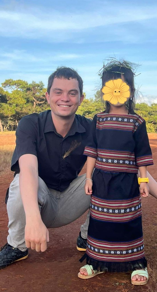
As I wandered, I noticed people gathering around a stage and decided to check it out, though I couldn’t shake the feeling of standing out. Just as I started wondering if I was even supposed to be there, I spotted my friend, Mr Suk, walking toward me with his two preschool-aged daughters. He’s a local-born English teacher I know from my time teaching his family here, and we’ve coincidentally worked on some of the same charity projects. His daughters were full of life, their energy lighting up the day more than any festival could. When one of them confidently said in English, “My name is… car,” I had to laugh and admire her playful confidence.
The festival itself buzzed with activity, featuring a traditional weaving competition and performances of local music. There were also stalls showcasing local organic produce, like peppercorns and macadamia nuts. Anticipation filled the air as judges examined the intricate brocades being woven, each thread telling a story of skill passed down through generations. Unfortunately, I missed all of that—arriving on the wrong day. The main events had wrapped up on Sunday while I was busy with work, and now, here I was on a Monday as the stalls were all packing up—such is the life of an English center teacher. With extra curricular classes to teach, I’m always tied up when everyone else is free.
I did arrive just in time to catch the awards ceremony on the big stage, where the winners of the previous day’s competitions were being recognized. There was a sense of pride and excitement in the air as the judges called up the winners to receive their prizes. I watched as different groups were called up, high fiving their friends as they came forward. Mr Suk’s family’s team won a prize for their brocade weaving, they were each awarded a framed certificate.
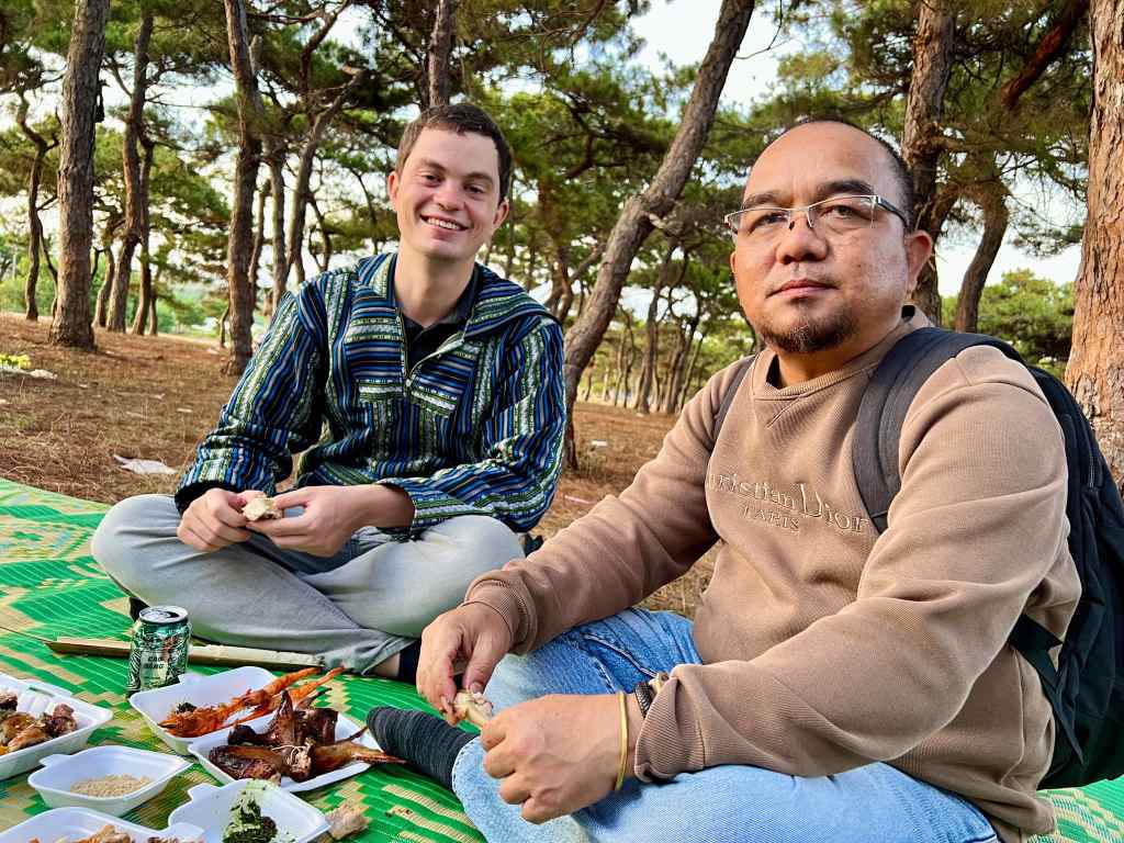
After the ceremony, we found a quiet, shady spot beneath the pine trees to sit on a woven mat. It was very pleasant in the late-afternoon sun. The soft breeze carried the scent of pine and earth. We settled in comfortably, and soon, our meal arrived—sticky rice, perfectly cooked, alongside tender grilled chicken. We ate together, savoring each bite in the relaxed, unhurried atmosphere. The girls played with their teddy bears that had been won at a fairground game: one capybara and one labubu – very on trend.
Driving back to Pleiku that evening, I felt a deep sense of gratitude for the friendships I’ve built during my time here. These connections have not only pulled me away from the isolation that can sometimes come with being a foreigner in smalltown Vietnam but have also added meaning to my days. Festivals like this help mark the rhythm of the year in ways that might otherwise pass unnoticed, especially for outsiders. It’s a unique perspective—to see these events as both a visitor and someone rooted enough to share them with friends, offering a richer, more personal experience.
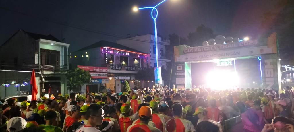
It’s still dark when I arrive at Biển Hồ 9km north of Pleiku City. I shuffle nervously through the large crowd, unsure of where to go or what to do. The PA crackles in Vietnamese, but I can’t make out the words. I’m surrounded by seasoned runners adjusting their gear and some people looking a little apprehensive like me. This is my first time running a 10k, but I’ve been training for months now, ever since I decided to take on long-distance running this summer. Before then, I’d never run for more than a few minutes at a time. So when I signed up for this event, I knew it would be a challenge.
Runners waiting at the start line before the sun has risen
I’d come here to pick up my bib a previous evening, and in doing so, bumped into a friend I hadn’t seen since I lived in Saigon – 4 years ago. It showed how much of a draw this event is, pulling people not just from Gia Lai but from all over Vietnam. Around the starting line, a small fair had been set up, offering everything from local produce to fitness and wellness products.
I’m not just running for myself today; I’ve been sponsored by friends and family, raising nearly £500 for local community projects. The weight of that generosity makes me feel equal parts proud and determined—it’s about more than just fitness for me now.
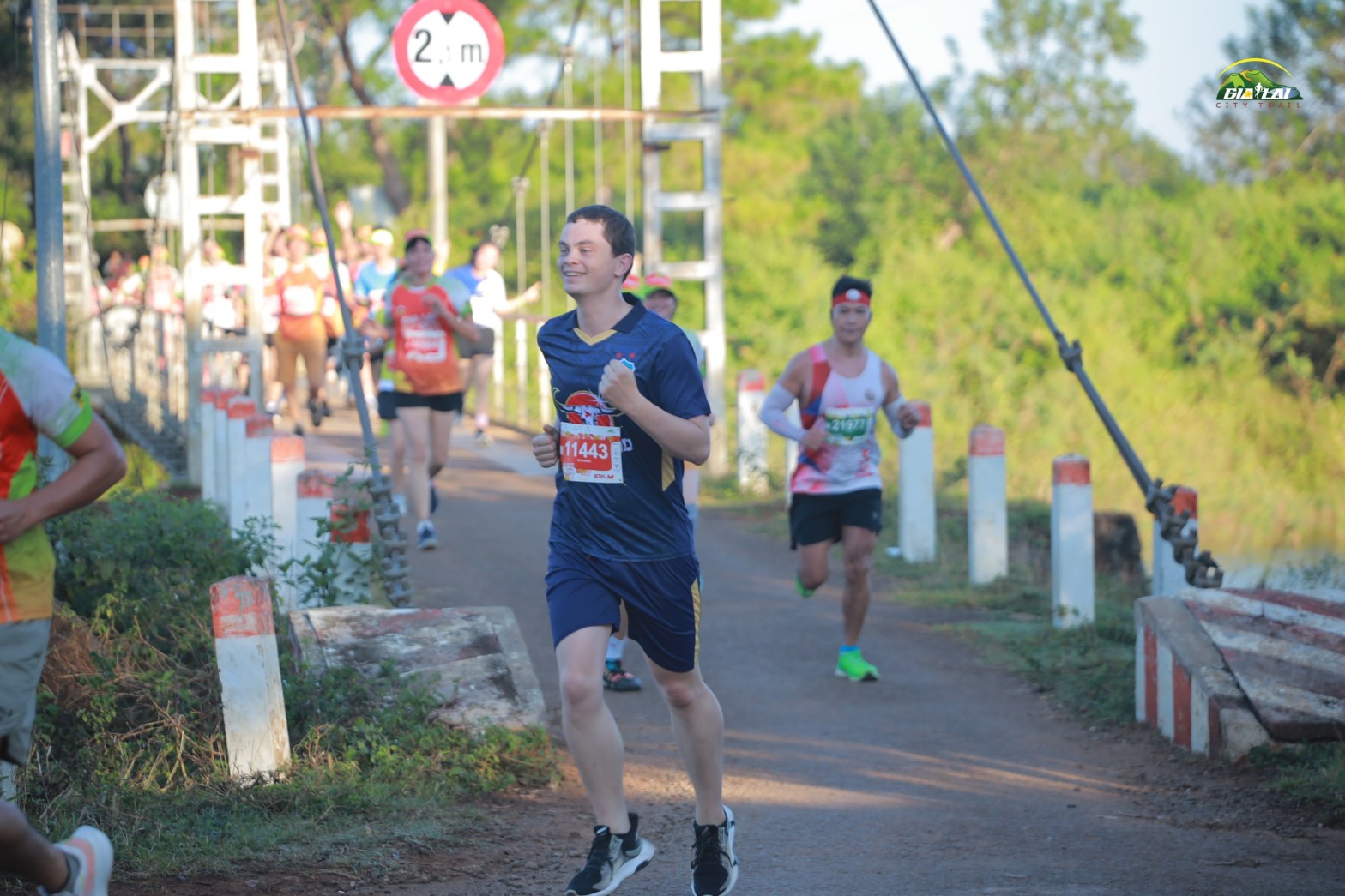
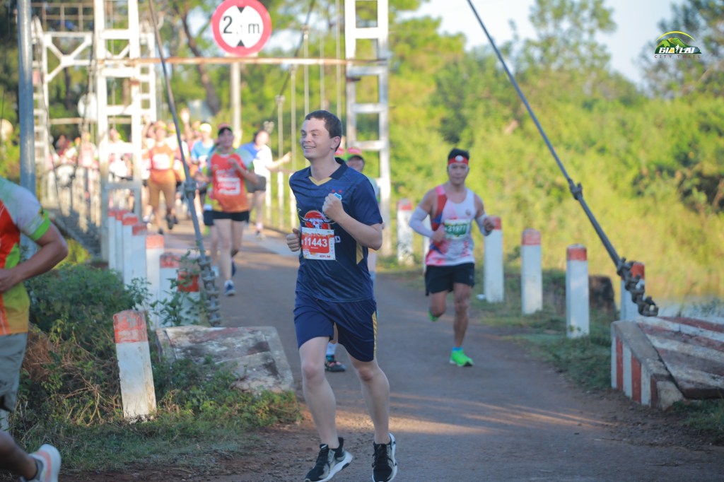
As the starting countdown ends, the mass of runners moves forward like honey dripping off a spoon—slow at first then spreading out as it gains momentum. In my effort to show appreciation for the local area, I’d chosen to wear the HAGL football team kit—Gia Lai’s pride. It’s my small way of connecting with this place that’s become home. The first corner hosts a Jrai band playing traditional music. I know these musicians from Pleiku Roh; they spot me, shouting and waving as I pass. Their cheers make me grin—a moment of connection that reminds me why I love living in Pleiku.
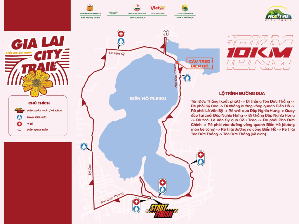
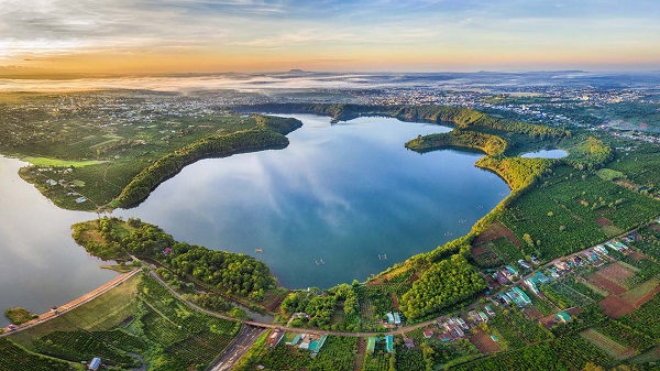
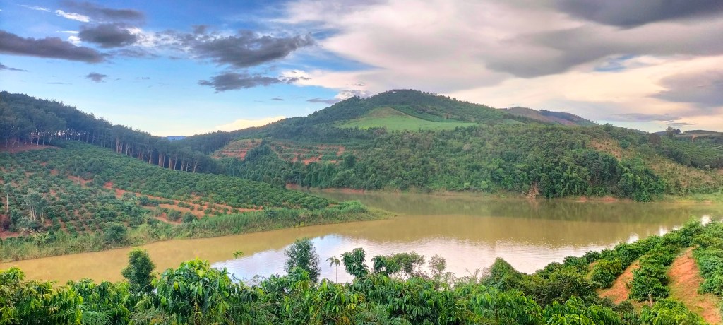
The 10k route encircles Biển Hồ lake – the “Sea Lake” of Gia Lai province, a popular tourist attraction. We set off clockwise, taking us first past its iconic pine trees. The lake itself is a remnant of volcanic activity, formed by overlapping craters, it covers and area of 228 hectares and conveniently for today, a lap around is about 10km.
Biển Hồ isn’t just beautiful; it’s a place of deep cultural significance. Stone Age tools discovered here hint at its importance to early human settlers. Of course there are several “pourquoi” origin stories of this natural feature. One story says the lake was once only a small spring. But when the magical giant white pig belonging to Ya Chao was killed to be eaten, water erupted, creating the lake and turning Ya Chao to stone.
The first kilometer or so of running flies by easily. We pass a local school where a marching band is playing. Their music is invigorating, blowing away the last vestiges of sleep as the sun rises.
My guilty secret is that I’ve never actually run a full 10 kilometers before. My best distance is 8.5 km on a treadmill, and life’s been so busy lately with a promotion and moving house that I had no time to complete my running training program. At this point, I don’t know whether to conserve energy or push harder. Some runners are already walking, while others surge ahead with confidence.
We reach Nghĩa Hưng dam, crossing to the northern side of the lake near the old French tea plantation. The main body of Biển Hồ lies to the south, while the northern reservoir, created by a dam in 1978, shimmers in the early morning sun. Although some people call this upper reservoir part of Biển Hồ, the Jrai villagers call it Ia Rơnhing, after the stream that was dammed. Although there was no dam prior to 1978, it wasn’t the first of it’s kind. Centuries earlier, the Cham people are said to have attempted hydroengineering here, redirecting water for their agriculture.
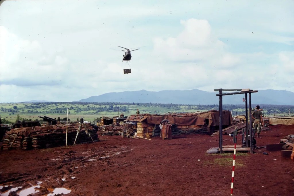
American wartime photo of Bien Ho before Nghĩa Hưng dam was built viewed from the northBien Ho after Nghĩa Hưng dam was built viewed from the north
French missionary Henri Maître recorded(source) an oral legend from the Jrai people dating back to the time of the Vijayapura Dynasty, when the Cham dominated Gia Lai. The Cham reportedly drained Biển Hồ to irrigate the Menam plains on the north side of the lake. However after suffering a major defeat to the rebellious Jrai in the 13th century, they were forced out of the area. As the retreating Cham tried to seize a valuable jar from the lakebed—that had belonged to the same Ya Chao from the origin myth—spring water burst forth, drowning their entire army and reflooding the basin. This tale, perhaps contains some grains of true historical events, as it aligns with the Cham’s presence in the region; a Cham-era archeological site lies just 14 km away in An Phú (source).
The next water station is a welcome sight as the sun gains strength heating up the trail. By now, the different race groups—10k runners, 5k runners, and marathoners—have started to merge. The path narrows, creating congestion. Shouts of “42 coming through!” echo through the crowd as marathoners on their final stretch try to pass. Some people step aside, but others remain oblivious. While it’s great to see so many enjoying the event, I can’t help but wish for some more displays of etiquette.
As we round the far side of the lake, I spot one of my students wearing a 5k bib. We exchange a quick wave, and I feel a spark of pride seeing different generations out here, embracing the event.
The last stretch takes us along the spit at the southern edge of the lake. A marshal shouts that there’s only 400 meters left. At the tip of the spit stands the Quan Âm, or Lady Buddha, shrine. During the war, Pleiku became a sanctuary for Buddhist communities under the South Vietnamese regime, which systematically favored Christians. The iconic Quan Âm statue, originally erected around 1969, was rebuilt in 2018 after falling into disrepair. While this revival has brought new life to the shrine, some locals who grew up with the 1990s structure—a hexagonal pavilion—view the change unfavourably.
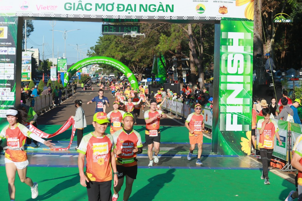
I got a time of 1h11:44
As I cross the finish line, exhausted but elated, a surge of emotion hits me. This wasn’t just about testing my limits; it was also about the generosity of the people who believed in me. Nearly £500 in sponsorship money will go to causes that matter deeply to me here. Thinking about the lives this will touch fills me with gratitude. Running around Biển Hồ, with all its beauty and history, feels like an offering in return. I remember this poem by Hồng Thanh Quang:
“Biển Hồ như tình yêu, Mặt nước chỉ hiện ra từng đấy, Nhưng ai biết ở sâu dưới đáy, Nó ăn lan rộng đến bao chừng…”
(“Biển Hồ is like love. Its surface appears only so, But who knows deep below, How far does it go…”)
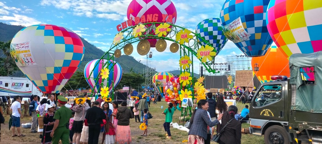
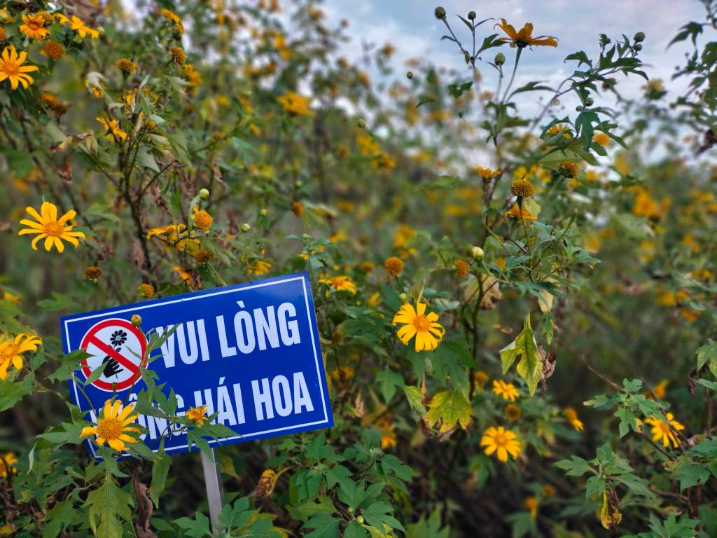
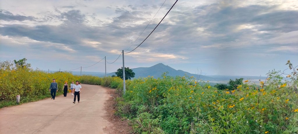
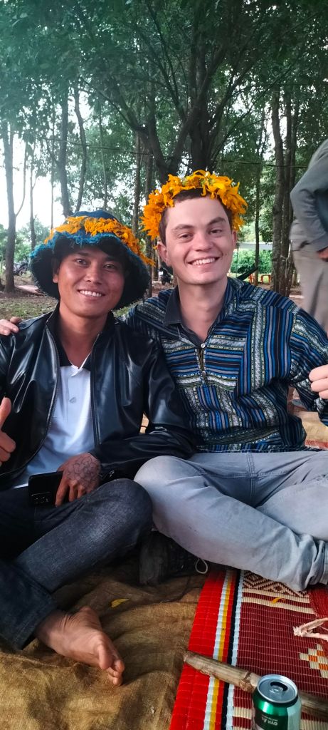
“Teacher Will!” a small voice calls out. I turn and scan the bustling crowd to see a group of my former students grinning and waving yellow flowers, dressed in striking black Jrai clothes with intricate brocaded trim. They’re selling dã quỳ wreaths, made from the bright yellow tithonia diversifolia flowers. The occasion? The annual Chu Dang Ya Flower Festival. Established in 2017 (source), this festival draws visitors from across Vietnam to witness the mountainsides bloom in early November, at the end of the rainy season.
Chu Dang Ya Flower Festival 08/11/2024
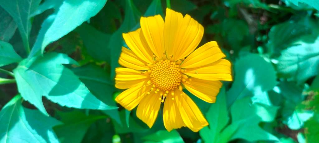
a da quy (tithonia diversifolia) flower
The girls are locals of the village that hosts the festival – a Jrai village about 20km north of Pleiku. They know me from the summer school I taught here this year. So of course, I buy a flower wreath. These flowers are so delicate that they start wilting almost immediately after they’re picked, so they have to work fast, making and selling the wreaths quickly before they fade. “Am I beautiful?” I ask them in Jrai as I put the wreath on my head. They laugh and assure me that I am.
My friends Jack and Jimmy, longtime expats, had different views about the festival’s authenticity. Jack described it as “a bit of a tourist trap,” while Jimmy had declared it “not worth the trip.” I decided to go anyway, having missed it during my four years in Pleiku (partly due to it being canceled during COVID), if only for something to write about. But as I walk through the grounds, I find something genuine in the community atmosphere. Despite the inevitable influx of outside vendors, I’m surrounded by familiar faces—some are my students and their families; others are friends who’ve come up from Pleiku like me. It reminds me of a village fête in England.
“please don’t pick the flowers”View south, Chu JorMy students having their photo taken by visitorsOne of the many photos taken by visitors
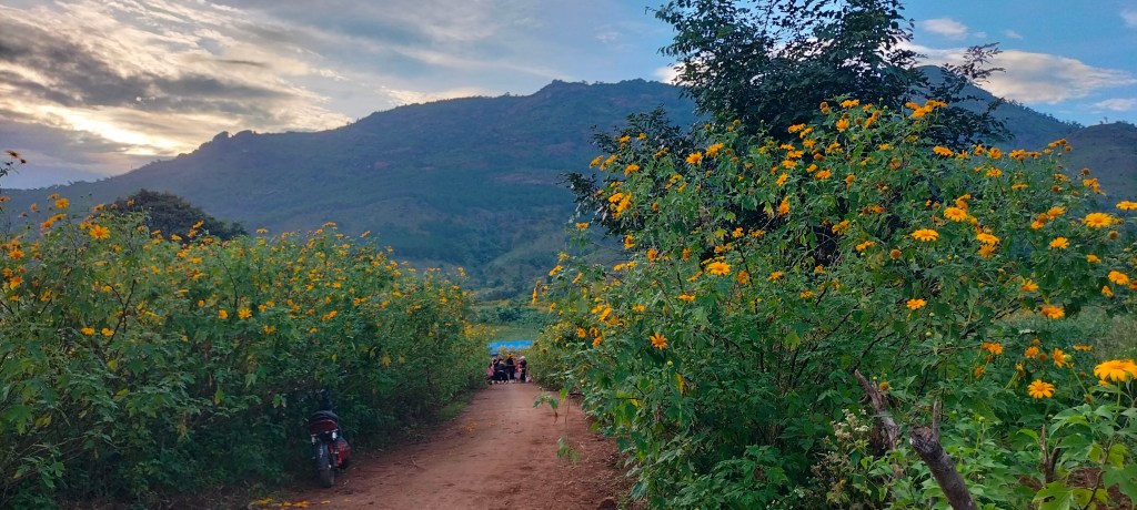
As I wander through the festival field with a large stage and up the winding road to the volcano there are hundreds of visitors taking taking portrait photos – this seems to be the main attraction for a certain type of visitor. People say that by the end of the festival, there are barely any flowers left on the plants as they’ve all been picked. However, for many locals the dã quỳ flower has become a symbol of Gia Lai province. Some expats have even gone as far as getting dã quỳ tattoos to commemorate their time in Pleiku. I don’t know how many people here know that the flower is not unique to Pleiku; Dalat even has their own Flower Festival which predates Pleiku’s (source). Although it is not native, the dã quỳ is a hardy flower and it has shown potential in raising the soil fertility in soils depleted in nutrients (source).
Chu Dang Ya crater with da quy flowers
Though the city dwellers love the sight of the flowers, many rural locals are less impressed.
“Hoa dã quỳ … I used to hate them when I was little. It turns out now they are the tourist attraction. I hated the smell and the feeling when I touch them. And at the time we had those wild flowers everywhere. I didn’t appreciate it. I was into those fancy flowers I couldn’t touch.” – Helen Nguyen, friend of the author, 4/11/2024
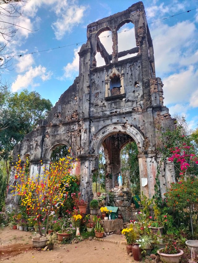
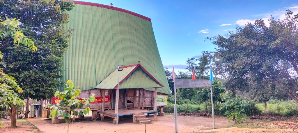
As well as researching the local flora, I’ve been looking into the local history lately too, with help from Brother Hiep, a local seminarian who helped me during the summer school. The village is important because it was the first Christian village of the Jrai people. According to the tale his mother would tell him when he was young (and supported by church records), the village was established by freed slaves under the guidance of French missionary Father Gabriel Nicolas (source). This seminal Christian community for the Jrai people became a refuge, the location chosen because of the ring of mountains that surround it – protecting the inhabitants from nearby slave-trading clans. Nicolas’s church, built in 1905, endured until it was destroyed in 1972 due to the war. Today, a single wall remains, serving as both a site for quiet Christian reflection and a tourist attraction.
Chu Dang Ya ruined church
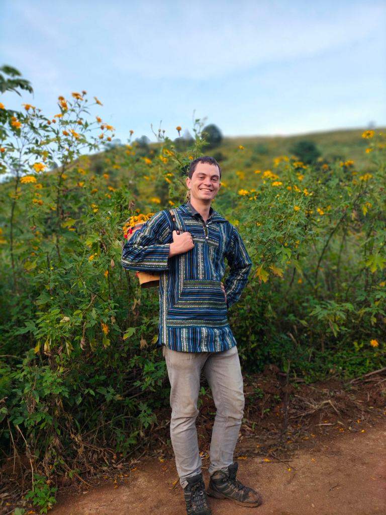
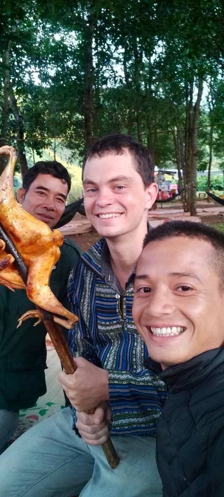
Eventually, between photo requests from Vietnamese holidaymakers and absorbing the festive buzz, I start to think about the one festive aspect I haven’t tried yet: the food. Before I can choose from one of the many food stalls, though, a group of locals sitting on a straw mat in an orchard waves me over to join them. I accept, joining them sitting cross-legged as they pour me a shot of rice wine in a shared glass, which they pass to the left, in the Jrai way. One man, dressed in an old Cambodian police jacket, insists on getting me a whole roasted chicken on a stick. I try to share it around, but he shakes his head, puts on a serious face, and says, “It’s only for you.” So I dig in.
My personal skewerda quy wreaths
The men casually ask a few questions that make me wonder if I’m being tested—‘What’s the name of the priest again?’ or, ‘Did you see him today?’ (I hadn’t; he was away in Saigon for four days.) They relax a little, maybe satisfied that I am indeed a friend of the community, and I win more of their trust by using what few words of Jrai I know. The conversation turns to local history, and I seize the opportunity to ask about the nearby church ruins and the village’s origins. One elder, born in 1951, confirms how the village was originally a settlement for freed slaves. With limited access to resources, they had to be resourceful—flavoring food primarily with ginger, which covered the forested mountains and gave the mountain its current name, Chu Dang Ya, or “ginger mountain” in Jrai. I try to absorb the details, but some phrases are lost in translation, and I feel as though there’s still so much I don’t know. I do catch a bit about salt shortages and subsisting on monkeys and cassava leaves, a sobering lesson in the struggles these first settlers faced.
As the sun sinks behind the prominent peaks to our west, my host insists on packing me some sticky rice in bamboo to take home. He also insists on giving me a lift back down the slope by moped, rounding off my visit with much unexpected kindness. For all the opinions about the festival’s authenticity, the dã quỳ seems to me to be an apt symbol here—they fade quickly, but their roots are resilient, nourishing the soil. This festival may have its commercial aspects, but it’s also a time for the community to come together. For anyone considering a visit, I’d say go. It’s good for the community, and as far as experiences go, this one’s a festival I’d return to.
My cousin Alice climbs Chu Dang ya surrounded by da quy flowers
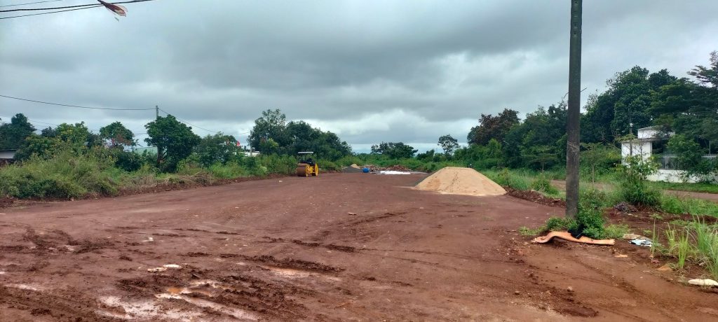
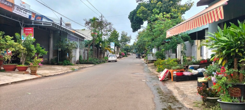
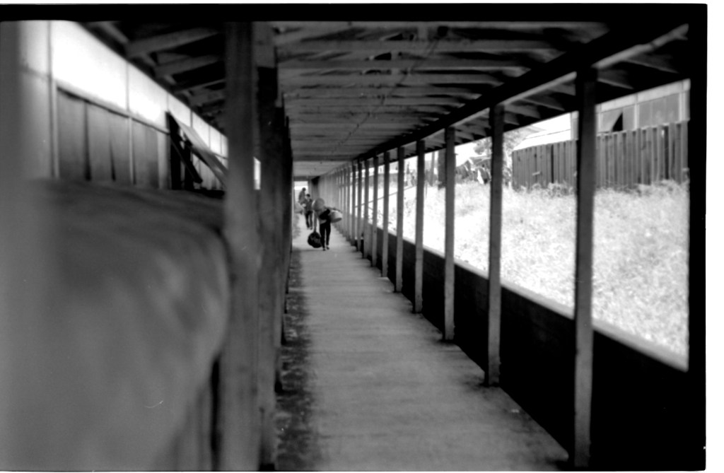
House hunting in a small Vietnamese city, like I’ve recently been doing here in Pleiku, is pretty stressful. There are no letting agents—just a Facebook group that moves at lightning speed. Thankfully, getting out to actually view places has been rather fun for me to offset the stress; it’s given me a chance to explore parts of the city I hadn’t had any reason to visit before. One viewing took me down the old French airport runway, now a public road, and another led me near the current airport onto the road that once led to the American 71st Evacuation Hospital. I get a bit of a buzz out of seeing these sites.
The old French runway, later Camp Holloway as it is nowThis used to be the road to access the 71st Evacuation Hospital. Now a quiet residential street. I didn’t go to the site itself because it’s not accessible to the public
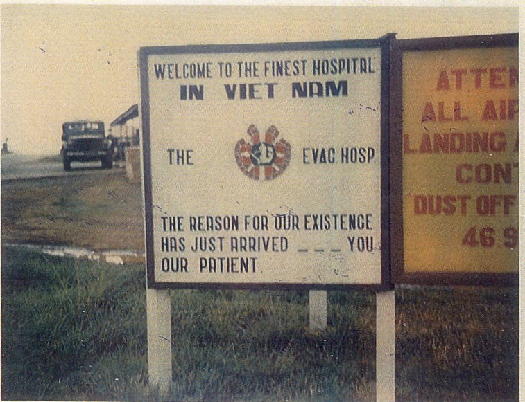
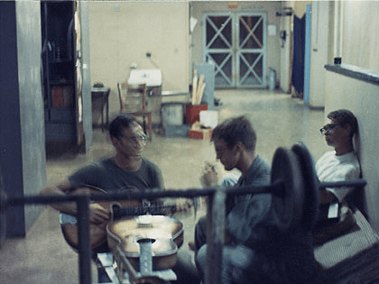
This gives me a good excuse to write up this topic because it took place at the 71st Evacuation Hospital (here). The site has no shortage of stories, such as the lives of the nurses who served there, like Diane Carlson Evans. Today, though, I’m sharing a snapshot of something more off-beat — a pirate radio station that was run by some rogue engineers. It’s a far cry from the official radio propaganda I’ve written about before, and just the kind of offbeat details I love learning about when digging into the history of Pleiku.
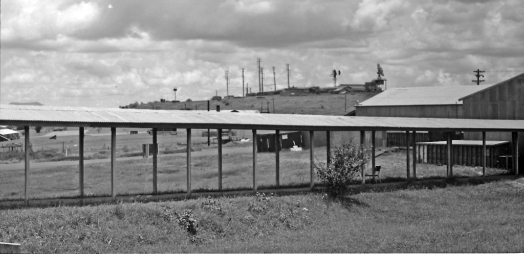
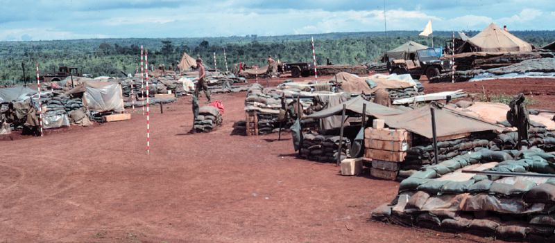
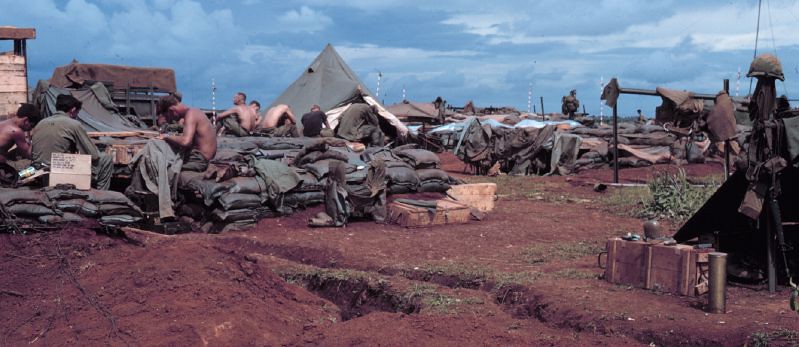
At the time the pirate radio was on the air – 1971 – the Vietnam War still had a good four years to go, but for the U.S. Army, things were beginning to wind down. Under the policy of “Vietnamization,” introduced by President Nixon, the U.S. was gradually transferring the responsibility of the war to South Vietnamese forces, aiming to reduce American involvement. The 71st Evac Hospital had reduced their staff considerably, giving the buildings that were no longer used over to the Signal Corps. The area had an eerie liminal quality that was captured in photographs by Joel Dinda who was with the Signal Corps and living in the Hospital grounds. The atmosphere of these photos brings to my mind the style of Wes Anderson film, which I also find a fun lens through which to think about the story around the pirate radio station.
71st Evacuation Hospital – Pleiku 1971 – photos by Joel Dinda
“By 1971 the 71st was but a pale ghost of itself, and most of the hospital complex had been either ceded to the local Signal Corps folks (that would include me) or completely abandoned. So I spent my Vietnam year living in a hospital ward… All in all, we Signal folks thought the medical operation a mysterious and wonderful thing; we shared the complex but had little interaction with the professional staff, and less with the patients. ” – Joel Dinda
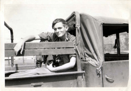
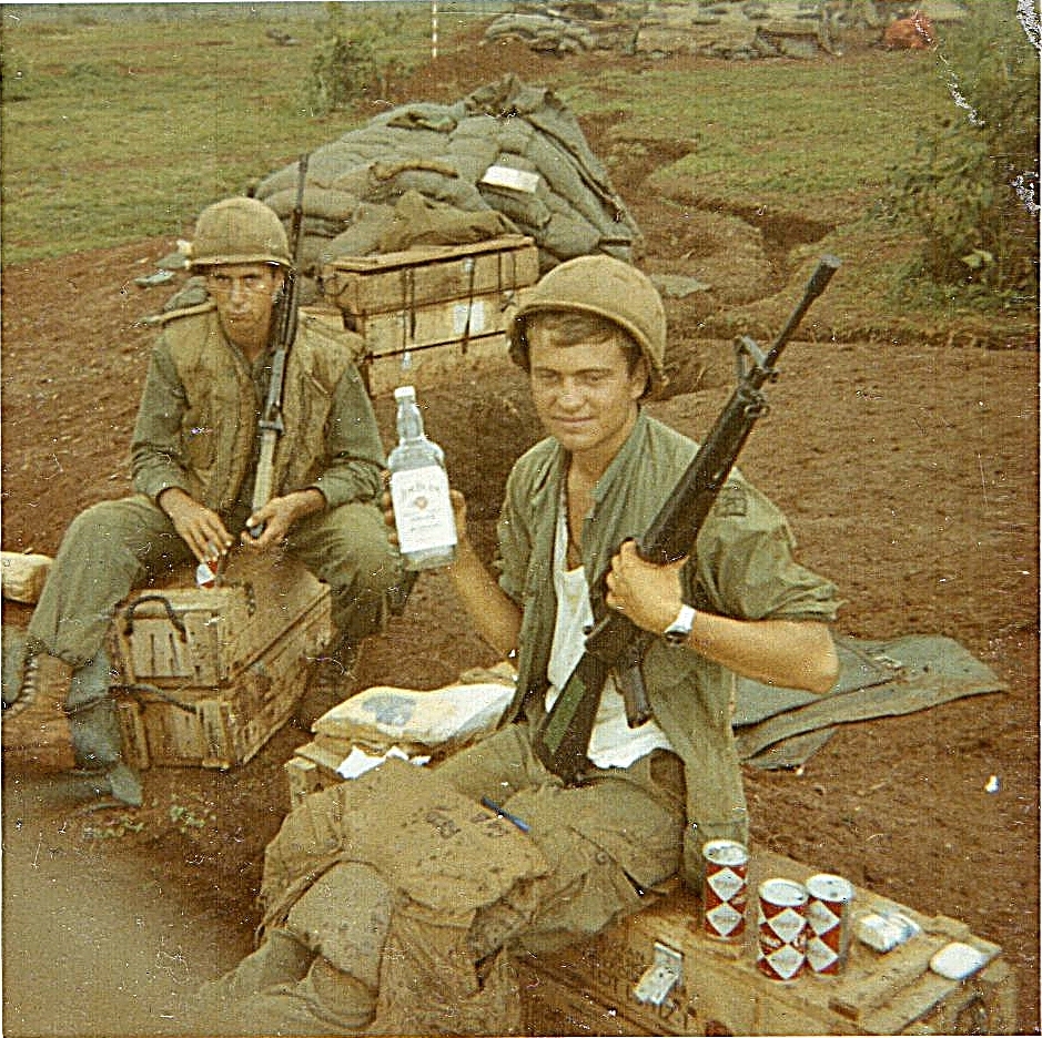
One of those signal folks was the main character of our pirate radio story: SP5 Schmidt of the 146th Signal Company. SP5 meaning Specialist 5-stripes rank.
“Since the war was winding down (for us GIs at least) a lot of equipment was being turned in to our shop from field sites reducing their inventory as they shut down. That provided a marvelous opportunity for me to scavenge an excess intercom for conversion to what would become the Peanut Whistle of the Central Highlands, so named after the HAM (amateur radio) nickname for a low power transmitter.” – SP5 Schmidt
SP5 Schmidt, stalled truck, Pleiku, April 1971
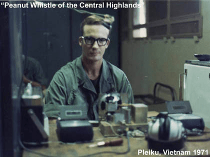
Schmidt and a group of co-conspirators from the his company used their vocational skills to cobble together a homemade broadcasting setup and started transmitting their pirate radio station on 95FM. They called it the Peanut Whistle of the Central Highlands, and each volunteer took on their own radio persona to remain anonymous – because what they were doing was strictly against the rules. Schmidt went by “The Choo-Choo-Cherry Kid” (a name inspired by his drink of choice: vodka mixed with Choo-Choo-Cherry powdered drink mix from care packages). Other DJs went by equally whimsical names like Goofy Grape and Rah Rah Root Beer. One of the crew had even been a professional DJ before being shipped off to Vietnam.
Peanut Whistle FM Station Console, Pleiku, 1971 Cassette (l), LPFM Transmitter (c), Cassette (r) Harmonica (front) for live concerts
SP5 Gray at the Peanut Whistle controls, 1971 (Photo by SP5 Schmidt)
146th EMS jam session.
The station didn’t exactly have a massive range—about two miles, depending on conditions—but that was enough to cover the medevac hospital and, the nearby Pleiku Airbase, and on a good day maybe Camp Holloway.
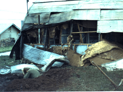
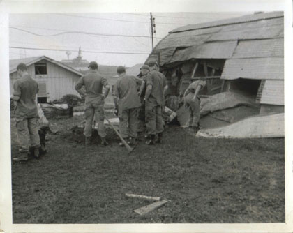
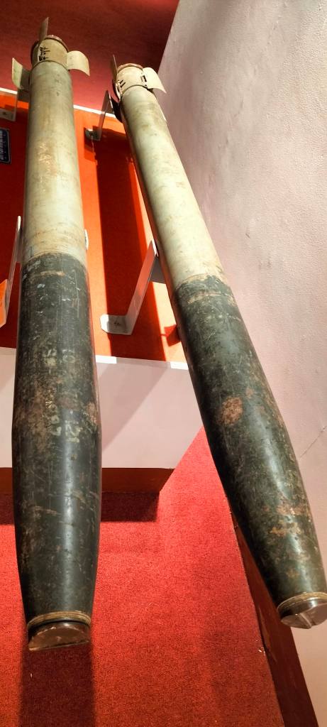
If you hop over to Schmidt’s website (my main source for this article), there’s more information about the pirate radio as well as a modest collection of photos and even some audio. One photo that caught my eye was of the officers’ latrine, which got hit by a 122mm rocket. Luckily, no one was using the facilities at the time. This was possible because the hospital was close to Rocket Box, the area I wrote about last time when I went to see one of the rockets in the museum. It’s funny how these things connect.
officers latrine at 71st Evac Hospital hit by 122mm rocket
The Peanut Whistle wasn’t the only pirate radio station operating in Vietnam during the war. One of the most famous was Radio First Termer, run by a DJ who went by the name Dave Rabbit. Broadcasting from a brothel in Saigon, Rabbit pumped out heavy rock and anti-war commentary, gaining a lot more fame than our Choo Choo Cherry but maybe that was due to his inner-city location.
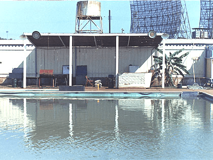
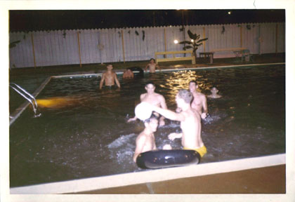
Fortunately, CCCK and his friends were never caught by the military police or other radio authorities. They even managed to throw pool parties at the medevac hospital’s pool—I was surprised to learn a pool even existed. I find a lot of joy in stumbling across these quirky stories, it adds a lot of colour to the history of my adopted home, Pleiku. There’s something absurd about this story—especially through the lens of the liminal looking photos.
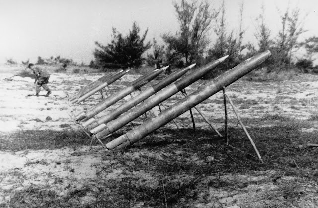
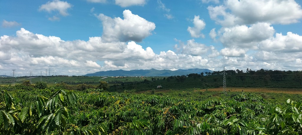
During the Vietnam War, Da Nang earned the nickname “Rocket City” because of the near-constant barrage of rockets launched by the Viet Cong. But what fewer people know is that Pleiku had its own version of this during the war, a place that became known to soldiers as Rocket Box. It was located about 20km from Pleiku the city, and was the area west of the POW camp and was bombarded with rockets fired from the jungle of Chu Prong. Back then, it was a hotbed of military activity, but today, it’s just another quiet stretch of land, its violent past largely hidden beneath the coffee fields.
“This area was called the rocket box, as it was the right distance for the enemy to fire 122mm rockets towards our base camp.(source)”
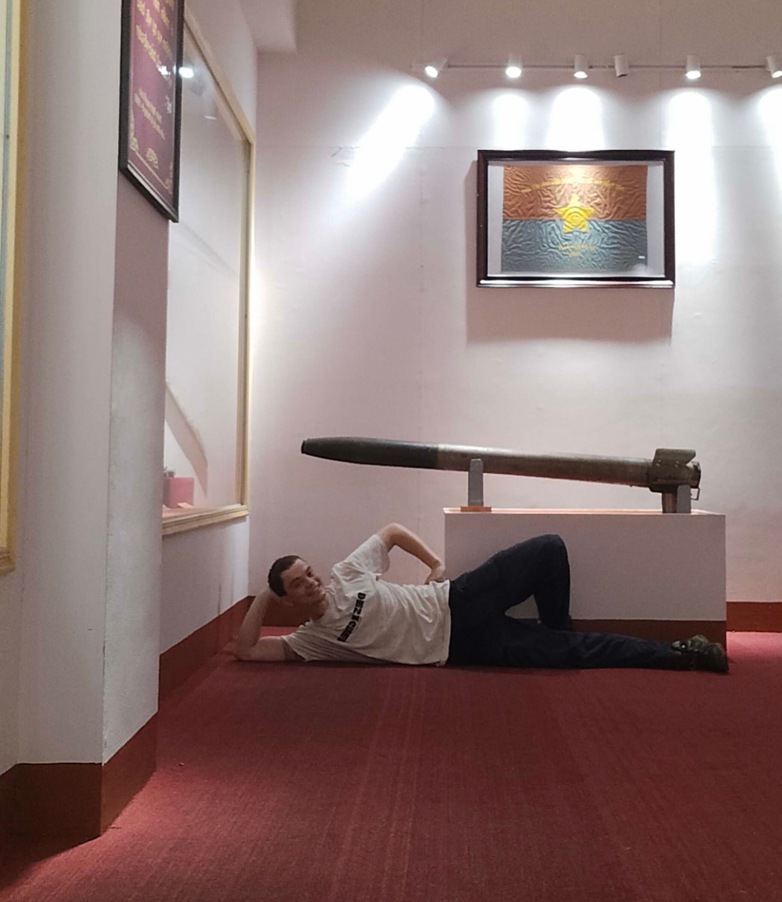
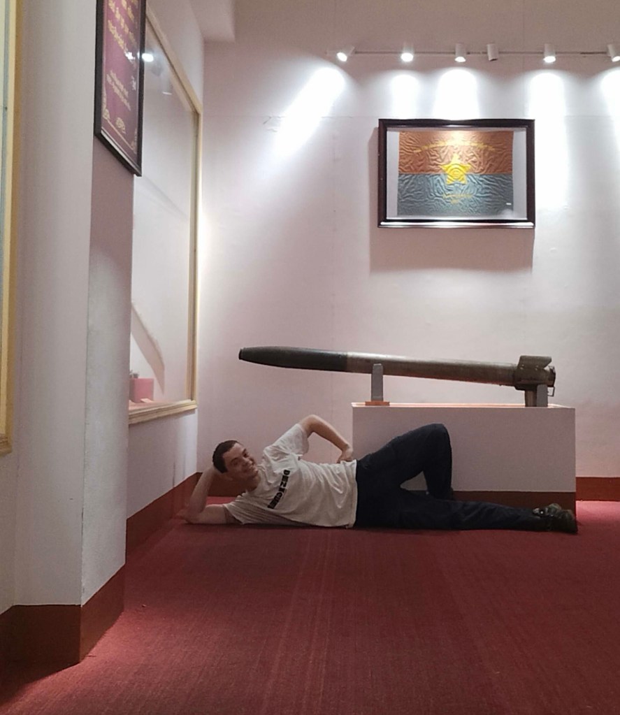
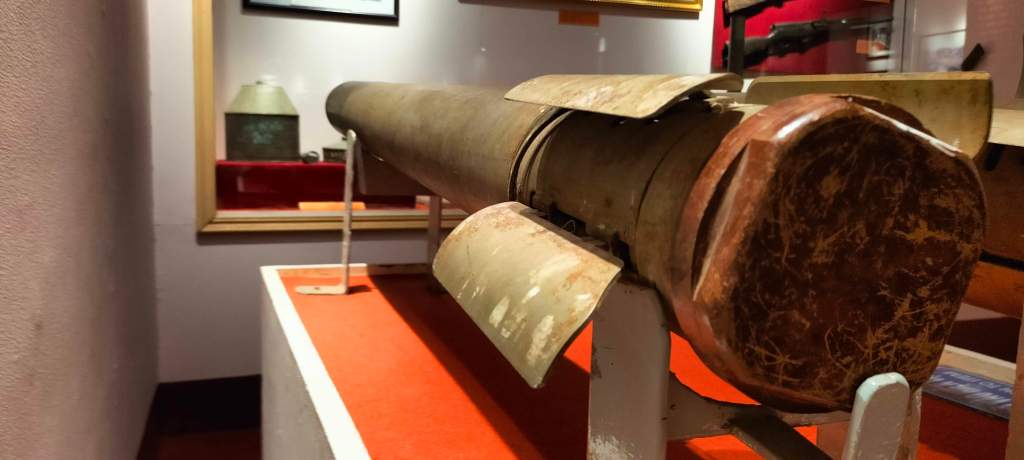
I wondered if some of the old 122mm rockets like those used at Rocket Box had found their way into Pleiku’s museum. I popped over to find out. After paying 10,000 dong for my ticket, I wandered inside, finding myself as the only visitor in the entire building. I quickly found the rockets upstairs in the war history room. Unfortunately, the staff seemed as uninspired as the museum’s attendance numbers. The woman at the front desk was chatting with her friend and didn’t seem the least bit interested in my questions about the rockets – where they were sourced or who might know more about them. I was met with blank stares and shrugged shoulders. So I took some photos and went on my way.
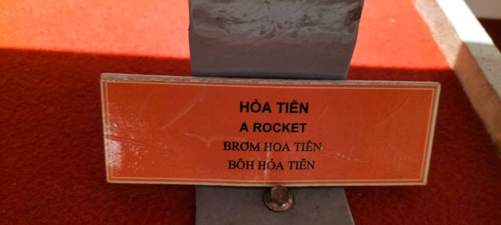
me and the 122mm rockets, Gia Lai Museum122mm rockets, Gia Lai Museum122mm rockets, Gia Lai Museumnot much info on the sign, but at least it’s in 4 languages. Vietnamese, English then Bahnar then Jrai (according to my students)
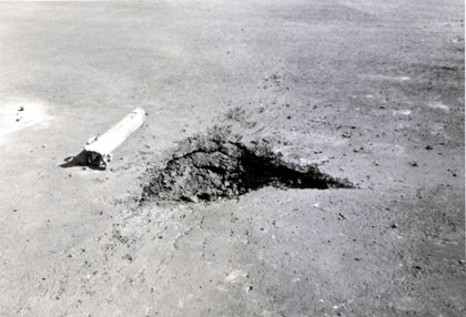
A 122 mm rocket impact crater at II Corps Headquarters, RVN, 1971
“The launch system was often just prop it up pointing in the right direction and shoot. But with no guidance system and a range of many miles to targets beyond sight, the VC couldn’t actually target specific buildings or predict where they would strike. That poor accuracy played to their advantage since they were pretty much for harassment and we all knew that even low value targets were just as likely to be hit as the high value ones.” (source)
example of how the rockets were crudely set up (photo not from pleiku)
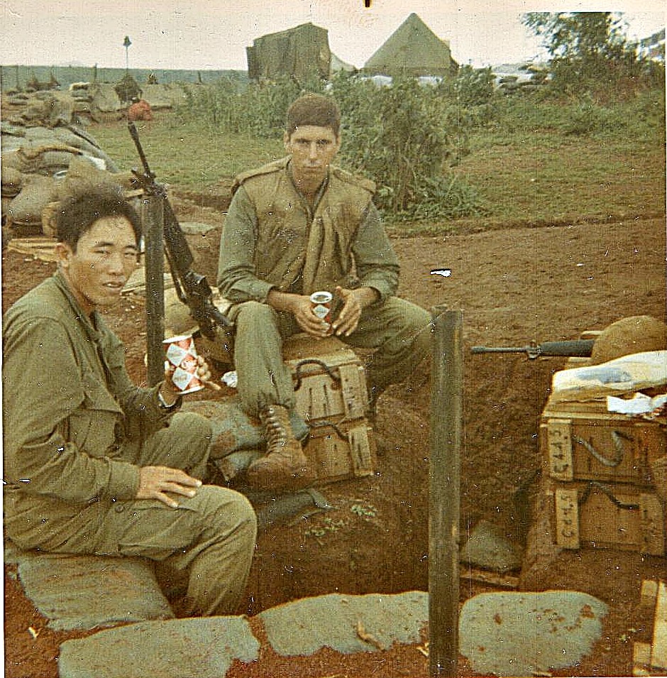
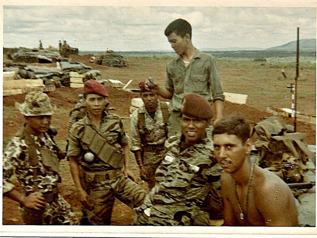
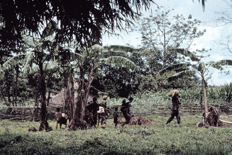
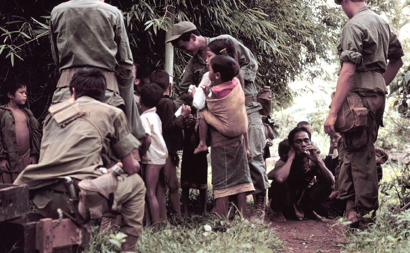
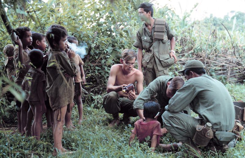
looks like the Chu Prong mountains behind, this is where the viet cong fired the rockets fromPhotos from Rocket Box in June 1969. Featuring Americans, Vietnamese and local montagnards (with the red berets)
“Every couple weeks the VC would fire missiles at us. While the rockets certainly weren’t harmless–people died in this incident–they were far more scary than they were dangerous. Typically, we’d be ducking nine rockets in a day: Three in the early morning, three more around noon, and three before supper. They’d set up the rockets on the outskirts of the city–near the whorehouses, I’m told–and retreat into the town before the Hueys could respond. The intended target was usually the local military headquarters (II Corps). Since our Commcenter was on the line defined by the launch site and the target, we had more than a few close calls. But by the second rocket in each set, we’d be in the bunker, wearing tin pots & flack jackets.” – Joel Dinda
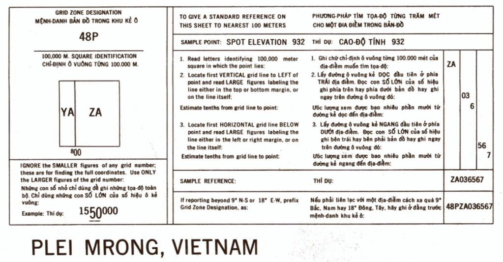
My next mission was to explore Rocket Box itself. I knew it was home to Landing Zone (LZ) Ruth (source, source), and I had coordinates for LZ Ruth: ZA168528. If that looks like an odd grid reference, that’s because it’s in MGRS format, which is a bit intimidating to interpret for the uninitiated. Luckily the old maps have a guide so I was able to convert it to latitude and longitude which can be put into google maps.
Guide to the MGRS system as seen on the map containing Rocket Box :- Plei Mrong 6537 II
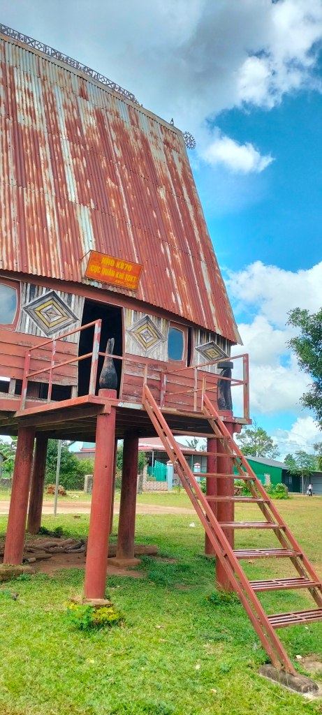
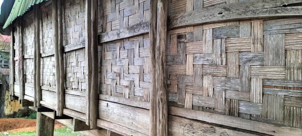
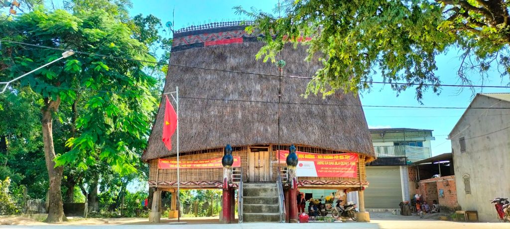
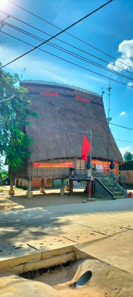
Armed with the coordinates, I set off, curious about what I might find—maybe an old crater or some other remnant from the past. The October air was cool and crisp, and we’re just entering my favorite season in Pleiku—the dry, chilly months that follow the rains. I took the bypass and turned off into a Jrai village where I stopped to admire the rong house, chatting with some local Jrai along the way. As usual, they were intrigued to see a foreigner wandering off the beaten path; one man even asked for a selfie, which has become something of a routine for me here.
rong house near Rocket Box
Americans interacting with the montagnard inhabitants of Rocket Box 1969
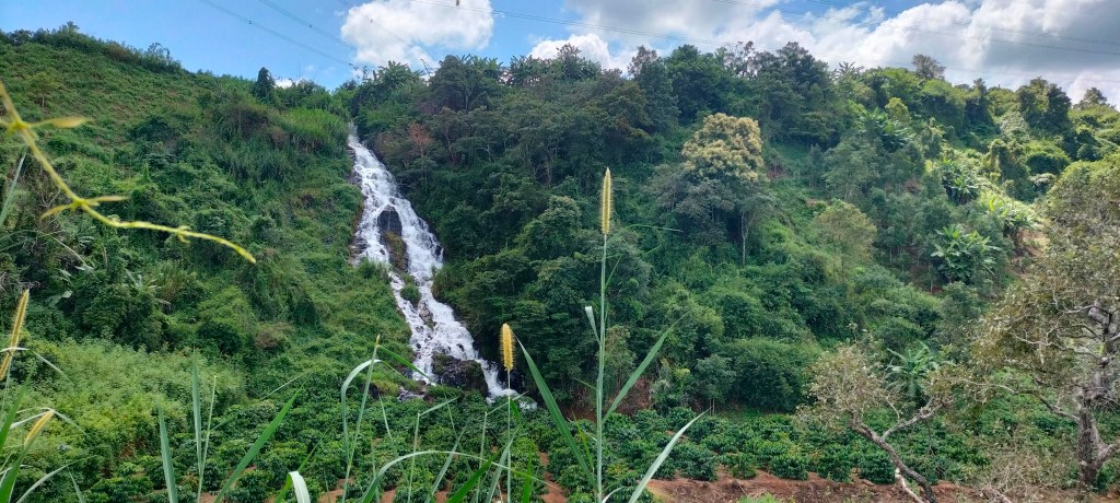
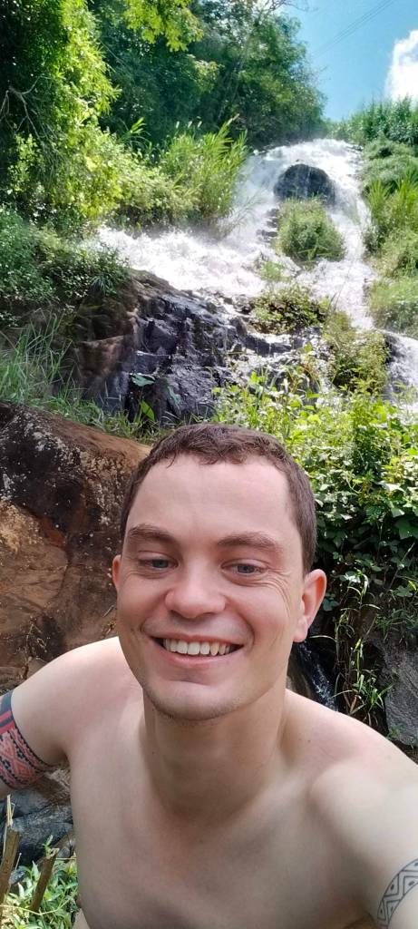
As it turned out, the Jrai I spoke to had something far better than craters—they told me about a little-known waterfall, not marked on Google’s map. Now, if you’ve traveled around Gia Lai with me, you’ll know that I love swimming in waterfalls. I can’t resist diving in, and this hidden gem didn’t disappoint. It wasn’t just a trickle either, but a full, roaring cascade that tumbled into a verdant hollow before flowing out to feed rice paddies. It was high noon by this time and the day had warmed up significantly. So the cool, shady pool at the foot of the falls was a perfect escape from the midday heat.
Rocket Box Waterfall
taps aff
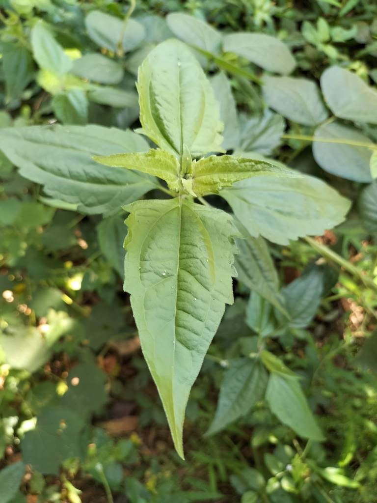
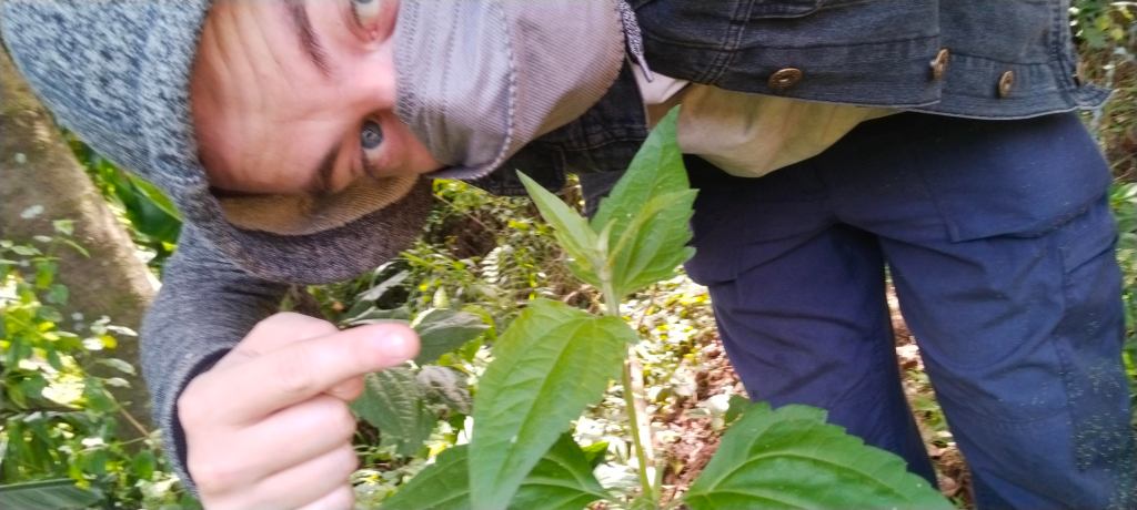
While I was relaxing in the hollow I noticed a remnant of the war – not a crater, but the flowering shrub chromolaena odorata, also known by the common name, “Jack in the Bush” (or in this case Jack in the Rocket Box!). It’s an invasive species from the Americas. The Jrai have their own name for it – they call it hruk se or hruk kŏ “airplane weed,” based on the folk belief that it was spread by US aircraft during the war (Jonathan Padwe 2020). In reality, though, it had probably been known in the area for a generation before that (according to the catholic missionary and ethnobotanist Jacques Dournes). Either way, it’s an interesting piece of folk taxonomy that highlights the association in people’s minds between the spread of the weed and the war era. This weed does well in areas affected by “bombturbation” – a term coined to describe how repeated bombing churns up the soil, mixing strata and altering the habitat. So it’s no wonder I found it thriving here in an area famous for being rocketed.
chromolaena odorata at Rocket Box
showing my distain for invasive species!
So, while I didn’t stumble upon any rockets or craters this time, the drive was nice, and my adventure led me to a hidden waterfall so it turned out to be a delightful day, and a reminder that the land has its own way of preserving history, even when the helicopters and rockets have long since gone.
18/10/20241969Rocket Box, Then and now
sources
Padwe, J. (2020). Disturbed Forests, Fragmented Memories: Jarai and Other Lives in the Cambodian Highlands. K. Sivaramakrishnan (Ed.), Culture, Place, and Nature.
While researching the story of Mereyna, I stumbled upon another curious episode featuring some of the same characters caught up in a rather different affair with the Sedang people—this time, a decade later. The deeper I dug, the more it became clear that this story deserved its own blog post.
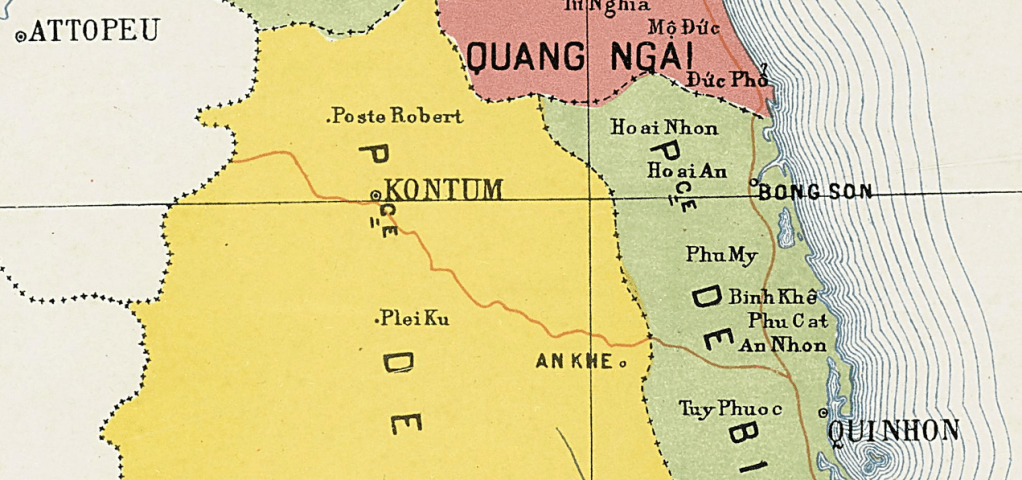
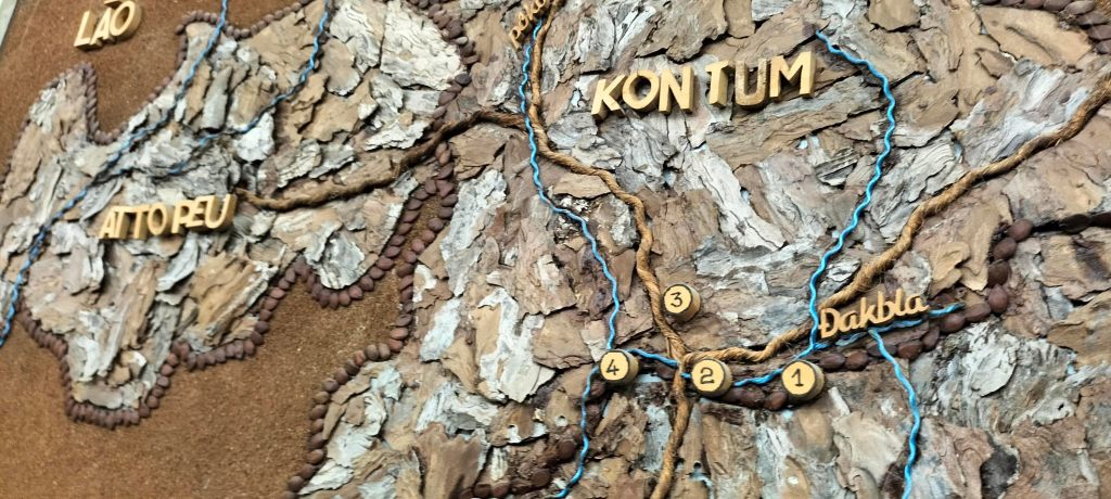
A place called Poste Robert kept popping up in the records. If you glance at a map of Vietnam from that era, you’ll find it marked just north of Kon Tum city, an odd name to see in the heart of the Indochinese mountains. Why is there a European sounding place name in the middle of nowhere? Naturally, I couldn’t resist the urge to dig deeper and also couldn’t resist taking a trip to see the location for myself.
Location of Poste Robert on a map for 1920
After the Meyrena affair in 1889, the French were keen to assert control over the region. A large enough force was brought in to try to bring the Sedang territory firmly under French rule. The Sedang, of course, were far from thrilled by this development. Their submission, as it turns out, wasn’t as easily won as Meyrena would have had people believe. They opposed the French presence vehemently, and tensions flared over the construction of roads and the increased numbers of outsiders.
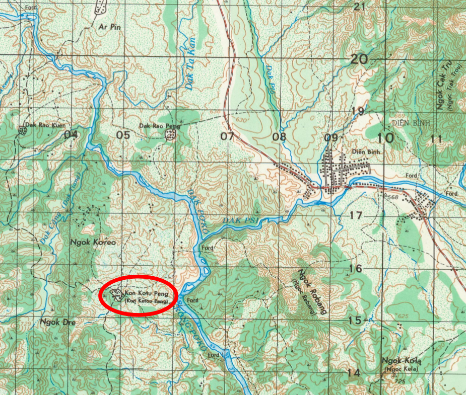
In 1901, a militia commander named Monsieur Robert was sent to establish an outpost near the confluence of the Poko and Psi rivers at a place called Kon Ketou. His task was straightforward enough: protect French interests and maintain some semblance of order between Attopeu and Kon Tum. Kon Ketou sat just 8km north of Kon Gung where the Meyrena episode had taken place a little over a decade before.
Kon Ketou as seen on a map from 1970
By all accounts, the Sedang were not pleased. The post disrupted routes they’d long used for trading commodities with the Jrai people to the south – these commodities were usually taken from the inhabitants of Quang Nam and Quang Ngai by force. Grumpy about this interference, some Sedang leaders decided it was time to remove Robert and his militia from the picture altogether.
Robert, aware of the tension, was warned of a potential attack and set up a guard. Thinking that no one would dare strike in broad daylight, he had the guard keep watch all night. So it was that on the morning of May 17, 1901 he dismissed the guards who had been on night-watch. That decision would prove fatal. At around 9 a.m., a group of roughly a hundred Sedang warriors launched a surprise attack. The post was caught with it’s pants down, and chaos ensued. In the melee, Robert was stabbed twenty times with spears before the attackers melted back into the jungle.
Enter Father Pierre Irigoyen—a name that might ring a bell from the Meyrena episode. He too had caught wind of the plot and, alongside Father Emile Kemlin, another missionary stationed nearby in Dak Drei, made a desperate dash to warn Robert. Unbeknownst to them, it was already too late. When they arrived later that evening, they followed the sound of gunfire through the darkness and found the surviving militias, who had already placed Robert on a stretcher, gravely wounded. Father Irigoyen took charge of the group and led them safely back to Kontum. Sadly, Robert’s injuries were too severe. Despite the best efforts of Father Guerlach, who treated him upon their return, Robert succumbed to his wounds.
The French, undeterred, rebuilt the post later that same year and named it Poste Robert in honor of the fallen commander. For a time, the name appeared on maps of the region, though by the 1970s, when the Americans took their turn mapping the area, it had vanished. Interestingly, the Americans followed the same tradition of naming military places after fallen soldiers, as seen with Camp Holloway in Pleiku City.
The incident was far from the last time the Sedang would show their dissatisfaction. In the years that followed, they launched several more attacks, including repeated raids on Father Kemlin’s residence in Dak Drei. These strikes were among the earliest signs that the Montagnard people wouldn’t be easily subdued by this western powers. The so-called “pacification” of the region would continue to drain French resources for years to come—stories I’ll explore in future posts—culminating in the Montagnards getting their final revenge at the battle of Mang Yang Pass.
For the purposes of this blog post I decided to visit the confluence of the Poko and Psi rivers, even though the precise location of Poste Robert is unknown. It was too tempting a geographical outing to pass up. It was about an hours drive out of Kontum by moped. There’s a Rngao village near the confluence, perched on the same west bank where Kon Ketou once sat. Upon arrival, I spotted the nha rong, a traditional communal house that stood proudly in the village. As I wandered about, a group of local kids gathered around to peek at me, their curiosity mixed with a hint of fear at the sight of a strange foreigner.
To break the tension, I decided to entertain them by pretending to be a zombie, and their laughter filled the village green, easing the initial awkwardness. With spirits lifted, I left my bike behind and made my way down to the riverbank, scrambling through fields and a rubber plantation as I went.
There was, of course, no trace of the French post. Nonetheless, it was easy to imagine the scene over a century ago when tensions ran high between the French forces and the Sedang people, with this peaceful riverbank serving as the backdrop to so much history. On the southwest bank, a round hill rose like a quiet sentinel. As I squatted in a bamboo thicket and looked across to the hill, I imagined smoke curling up from behind a wooden stockade while Sedang warriors, perhaps in this very spot, crouched in the undergrowth, planning their assault.
My adventure took an unexpected turn when I got a nasty bite from a centipede, a sharp reminder that this land, despite the rolling fields, hasn’t quite surrendered to the encroachments of civilization and still has surprises from its wild past. Limping back to my bike, I struck up a conversation with some locals who eyed me with a mix of curiosity and caution. I was particularly taken by the village’s charm, where many houses—though they were the typical modern brick bungalows found throughout Vietnam— sported extensions crafted from woven bamboo.
What struck me most about when researching this post was how a simple curiosity over a strange name on a map led me right back to the familiar names of Irigoyen and Guerlach. It’s a reminder of just how deeply these missionaries were woven into the fabric of the region’s history, their influence reaching far beyond the confines of their religious work. It leaves me wondering what adventure their mark on history will lead me on next.
The confluence of the poko and psiThe confluence of the poko and psiA Nha Rong in the rngao village near where Kon Ketou used to be.woven bamboo on the nha rong, many of the houses had extensions made in the same way.
At VUS, where I teach, we have a lesson for secondary students on the topic of what their town was like in the past. Of course, this is perfect for me, a self-declared local amateur historian. But a recent comment from my teaching assistant stopped me in my tracks. She mentioned that when she was young, there were no cinemas in Pleiku. This caught me off guard—surely there had been cinemas in the past, hadn’t there?
Before 1975
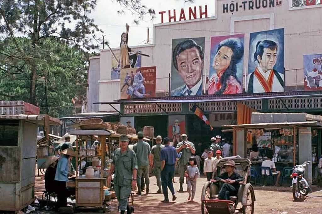
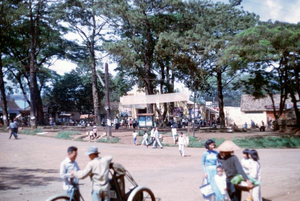
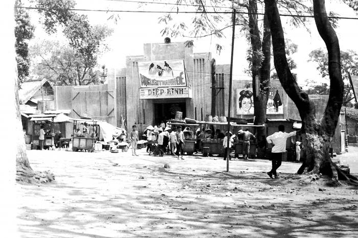
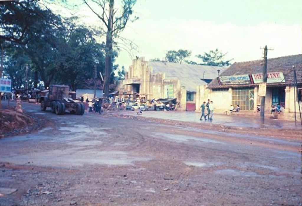
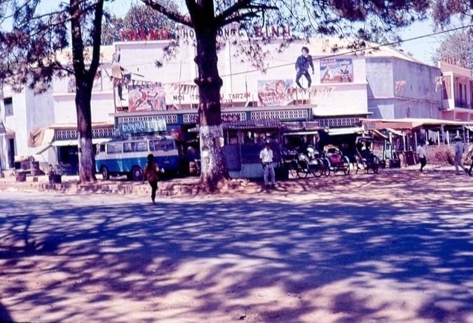
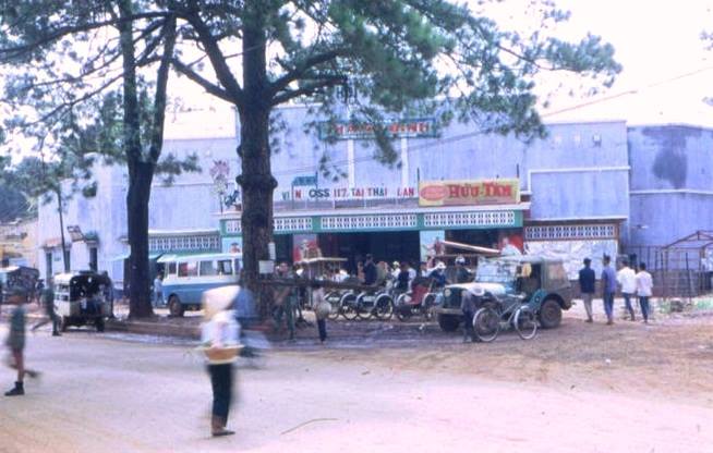
Some digging revealed that Pleiku did indeed have cinemas, even before 1975. And not just one, but at least two large theaters: Diep Kinh, Thanh Binh. They were on Hoang Dieu, the main road now called Hung Vuong, less than 300 meters apart. These theaters even had mezzanine seating, classy! (source)
Diep Kinh Cinema
Before 1975, Diep Kinh cinema was built at this intersection, named after the theater owner. Gradually, people got used to the name Diep Kinh so it also became the name of the intersection [note: the corner of Hung Vuong and Le Loi]. At that time, a cinema was something extremely luxurious. Therefore, since the cinema opened, many restaurants and hotels have sprung up one after another at Diep Kinh Pleiku intersection. – VAN CONG HUNG
When talking about Diep Kinh at that time, many old men and women remember that it was a gathering place for “flower girls”. Every evening, they would put on beautiful makeup, gather at the Diep Kinh intersection and sit in groups. The bustling crowd caused many fights between protection gangs when some shaggy customers appeared, teasing the girls or defaulting on their payments, causing trouble. – VAN CONG HUNG
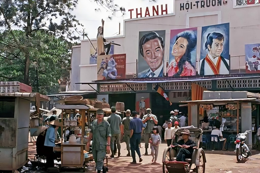
Thanh Bình Cinema – Pleiku 1969 – (formerly Thăng Long Theatre)Thanh Bình Cinema – Pleiku 1969 Photo by Dave Bakerwider view of Thanh Binh CinemaThanh Binh Cinema
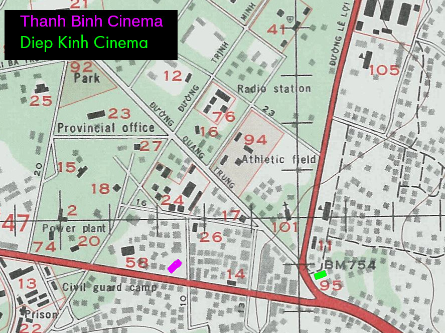
colour-coded map of cinemas in Pleiku. The red road going east to west is Hoang Dieu (now Hung Vuong).
A third cinema is mentioned “Diên Hồng” which was renamed Thống Nhất after the war. I can’t find any photos or the location of this cinema (maybe somewhere around Cu Chinh Lan street).
After 1975
After 1975, there were 3 cinemas in Pleiku, the largest and oldest Diep Kinh, then Thang Long and Dien Hong. Except for Diep Kinh, which took the owner’s name, the other 2 were also private but had the generous names Thang Long and Dien Hong. After being taken over, the government renamed the cinemas Nhan Dan (Diep Kinh), Thong Nhat (Dien Hong), while Thang Long was transformed into the Provincial Cultural House, now the Dam San Music and Dance Theater. –VAN CONG HUNG
At that time, there were several sources of films, foreign films were mainly from the Soviet Union, occasionally Polish films, Czechoslovak films… which had to be approved in advance. The approval board was set up by the Department of Culture and Information, I was occasionally invited to attend, and enjoyed it very much. –VAN CONG HUNG
The film was shown in Pleiku town until it was strung up before being transferred to the districts for the mobile projection teams, so it was normal for the film to be spliced or interrupted while showing. The dubbing versions were torn or blurred, so to be good at dubbing, one had to know how to… lie. I was sometimes invited to narrate for the mobile team showing at the outdoor theater (now a corner of Dai Doan Ket Square), and I also had to… lie, sometimes making up half of the film without anyone knowing. –VAN CONG HUNG
In the course of my research for the two-part series on the Kingdom of Sedang, I stumbled upon references to a village by the name of “Kon Djéri Kong”, the site where Guerlach said he was based for his catholic mission at the time. I thought knowing more about the place might give me something to add to my blog so I set out on a quest to find it. My journey began with a lead from a Bahnar acquaintance in Kontum. She suggested that the village might Be Kon Jo Dreh nestled on the banks of the Bla river, a little way upstream of Kon Tum City.
Fortune smiled on me when a work event scheduled in Kontum gave me the perfect excuse to take a detour into the countryside. I decided to make the most of it and set off with the vague hope that I might unearth some fragment of the past.
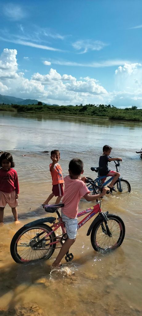
To reach Kon Jo Dreh today, you start on the three-lane highway towards Mang Den, then turn off onto a crumbling, stony road just before the endless rows of rubber trees. As I drew closer to the village, a group of children noticed me and began to follow, some running and others wobbling along on oversized bicycles. Their laughter and whispered chatter provided a lively soundtrack to my otherwise solitary journey.
I visited the village center, where a rong house provided shade for a small vegetable market beneath, next to it was the dignified structure of a squat chapel standing quietly in the afternoon sun. The villagers, kind and welcoming though they were, seemed baffled by my questions. The name Guerlach drew blank stares, and no one knew of any historical missionary. It was disheartening but not entirely surprising; so much has changed in this area over the years. Giving up on my research, I decided to make the most of the sunny afternoon and wandered down to the river, the children trailing along behind me. They entertained themselves by showing off their English, each proudly declaring, “My name is…” followed by whatever made them laugh: “My name is Spiderman,” “My name is Ronaldo.” I recognized this game from my volunteer teaching days, so I joined in with, “My name is Hla Blang!”—a local cassava leaf dish. The kids burst into raucous laughter, delighted by my attempt, and I knew I’d won them over.
A rong house in Kon Jơ Dreh
A rong house in Kon Jơ Dreh
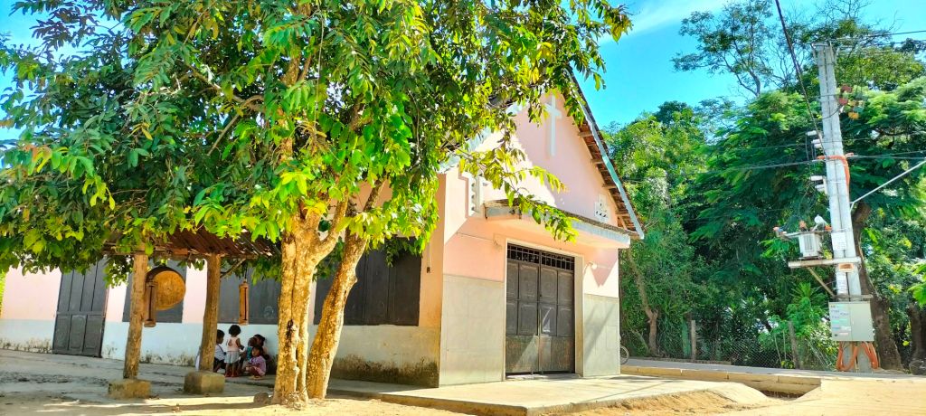
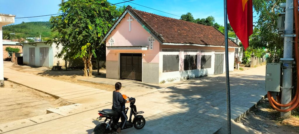
A chapel in Kon Jơ Dreh
A chapel in Kon Jơ Dreh
Kids followed me down to play in the Dak Bla river
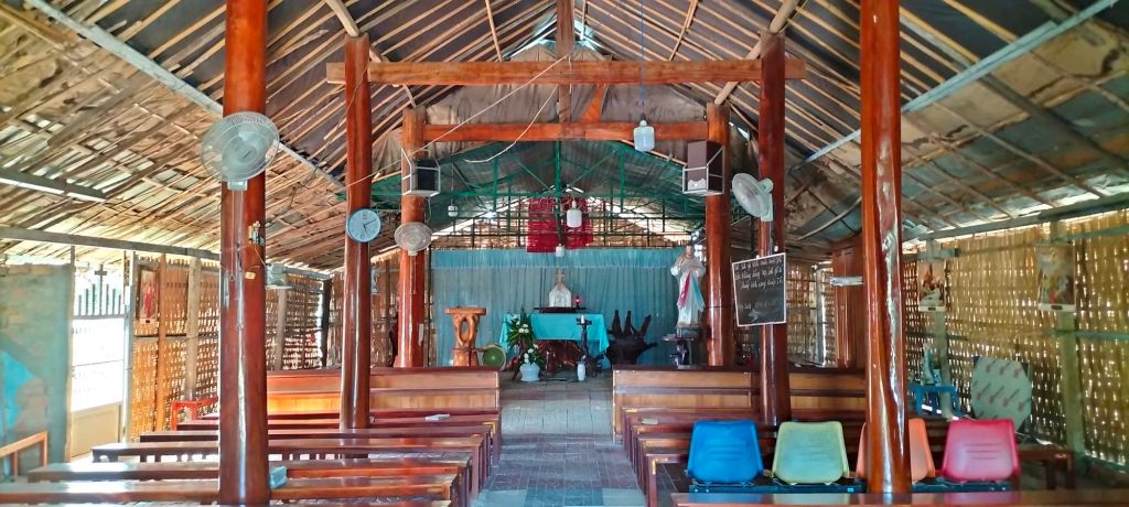
After leaving Kon Jo Dreh, I stopped at a church I’d seed from the road called Kon Kơpăt. I was invited into the church by a group of elderly women, who were busy preparing flowers for some forthcoming celebration. The church had a brick front but the back had crumbled to ruin and had been rebuild from wood. The effect was beautiful. The ladies spoke R’ngao, a language that was new to my ears but related to Bahnar. They began to teach me a few basic phrases, laughing at my clumsy attempts. It was a delightful and unexpected exchange.
Kon Kơpăt church
As I headed back to Kontum, I reflected on the unpredictable path outings can take. Chasing the ghost of an obscure mission had brought me into the heart of a community, where I picked up a few words of the local language and rediscovered the joy of connecting with new people. Living and working here as an expat, it’s easy to fall into routine, but working on this blog—regardless of the outcome—gives me a reason to get out, explore new places, and meet people I’d otherwise never encounter. While I found no trace of Guerlach’s mission or even figured out if Kon Djéri Kong was the same as Kon Jo Dreh, I was reminded that it’s the experiences that make writing this blog worthwhile.
In part 1, we explored how Mayréna lead an expedition into the wild jungle near Kontum, Central Vietnam. Here he succeeded in thwarting a rival Prussian expedition and thus secured French dominance in the region by forging alliances with chiefs of the Sedang Tribe; the last tribe standing in the way of a road from Quy Nhon on the Annam Coast to Attapeu in Laos.
In this second part, we will delve into how Mayréna seized the moment to declare himself king of an independent Sedang kingdom — a bold move that would set the stage for his own downfall.
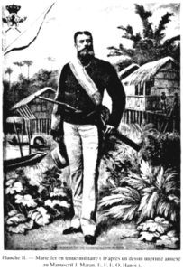
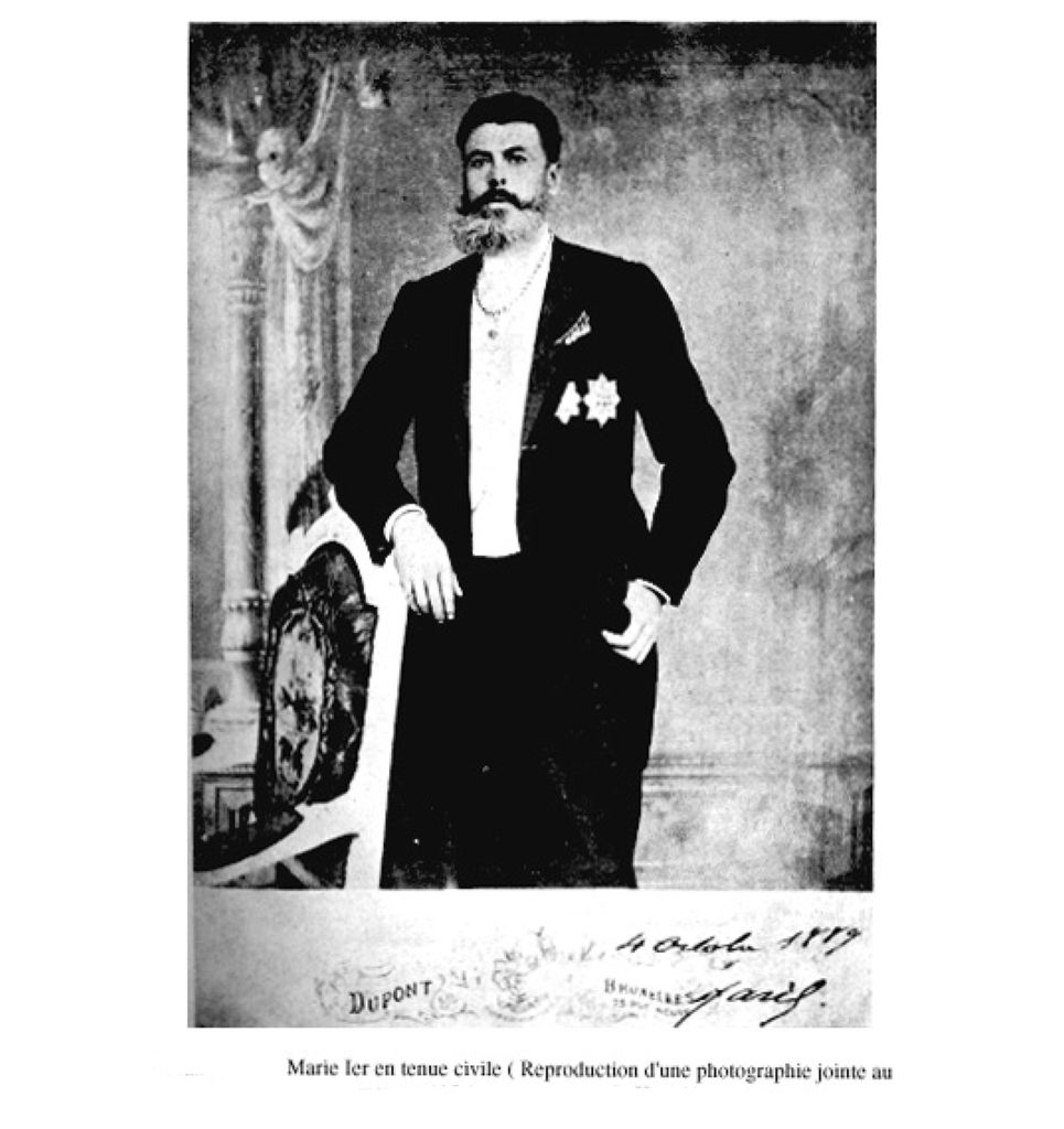
Charles-Marie David de Mayréna
Earlier in their mission, Mayréna had informed his guide and interpreter, the missionary Guerlach, that the governor-general of French Indochina had strictly ordered Mayréna not to act in the name of France. Recall that this mission was entirely unofficial, in order to avoid causing diplomatic problems. So when initially Mayréna was asking the Sedang chiefs to sign allegiance to him personally, it did not ring alarm bells for Guerlach.
The expedition would set up their forward base at Kontum which was well established – having the Christian mission, 4 converted Bahnar villages and a small Vietnamese population. Mayréna would take three forays from Kontum to the Sedang land, collecting signatures from various village chiefs on treaties while missionaries translated and signed as witnesses.
Over time Guerlach grew increasingly uneasy with this approach. Although he signed the treaties as a witness, he would later clarify this was in no way an endorsement. His letters suggest he felt Mayréna was not acting in the best interest of France, and after the second foray to the Sedang land, Guerlach seemed to distance himself from his countryman. For the third and last foray, it was Father Irigoyen, a missionary stationed at Kon Trang, who acted as interpreter for Mayréna. After this Mayréna would not see the Sedang people ever again.
At this point I want to step aside from the story to explore how and why all this happened. Mayréna’s own account was that after he had impressed the Sedang with his skill with a sabre, he was asked to lead the Sedang against a neighboring tribe, the Jrai, and upon his victory the chiefs spontaneously declaring Mayréna king totally unprompted. Although this is blatantly a lie, evidence from more reliable sources does indeed back up that the Sedang chiefs did indeed crown him king of their own freewill. Was this due to Mayréna’s charisma, or was he merely a clever opportunist who exploited the hard work of those like Guerlach? After all, it was the missionaries like Guerlach who had lived among the Sedang, learned their language, and won their respect through years of hard work. Maybe it was simply a matter of time until they won over the Sedang – and Mayréna turned up at just the right time.
I, Blak, first chief of the village Dry or Drey, declare that my village and its inhabitants; its lands and its rivers is a village of the kingdom Sedang; furthermore I declare to call and recognize His Majesty Marie, king of the whole kingdom Sedang, and my king; furthermore, I declare that, from time immemorial until this day, I have never called and recognized a king chief of another country; today only, I, first chief of the village of Dry, call and recognize His Majesty Marie, king of the whole kingdom Sedang, and also king of the village of Dry, and its dependencies; again I declare to have heard and understood all the things that the king of the kingdom Sedang orders to be observed in each village of the kingdom Sedang [snip].
and the undersigned, P. Irigoyen, apostolic missionary, declares that the above French translation is the literal of the Sédang Convention passed before me by the village of Dak Dry. Signed: P. IRIGOYEN, Apostolic Missionary.
My theory is that the Sedang may have overestimated Mayréna’s standing within the French Empire. The chiefs likely sensed that their traditional way of life was under threat and would not survive the march into the 20th century. Surrounded by powerful empires, they must have realized that securing a strong ally was essential for their survival. Unfortunately, their error was in believing that Mayréna was the ally they needed. With the confidence and charisma of a seasoned conman, he convinced them of his influence and power.
One thing is certain: the Sedang people were never called upon to demonstrate their loyalty. I suspect it would not have been easily given, as their commitment to Mayréna’s supposed kingdom was likely tenuous at best. Perhaps Mayréna was well aware of this and understood that their loyalty was irrelevant to his true intentions. His plans were never about building a lasting kingdom for the Sedang; rather, they were about using the illusion of one to serve his own ambitions.
Back to the story, after the third foray with Irigoyen, Mayréna left the highlands and returned to civilisation. The likely reason being that without Guerlach’s support Mayréna would not be able to set up more meetings with more chiefs. Or maybe he just felt he had gathered enough signatures to lend weight to his scheme. Whatever the reason, he quickly put a lot of distance between himself and his supposed kingdom, travelling first to Hong Kong. Here, he would write prolifically to quickly put spin on what he had done.
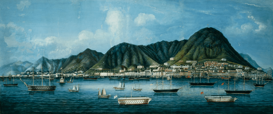
Hong Kong 1860s
Mayréna boasted that he was received as royalty in Hong Kong, likely embellishing his exploits to gain favor and attention. With his newfound status, he wasted no time in exploiting his self-proclaimed kingship to its fullest. He began selling titles, land, and mining rights, to gullible buyers enticed by the promise of influence and wealth in his so-called kingdom. Many of these transactions were dubious at best, as Mayréna had dubious power to offer such assets. Regardless, he pocketed the profits and indulged in a life of luxury, parading his fabricated success while living off the proceeds of his fraudulent schemes. His reign, built on deception, became less about leadership and more about how much he could extract from Europeans.
To a world that had never heard of Sedang people, Mayréna had to justify his right to rule, Mayréna wrote at length to passionately argue that the tribes were not, and never had been, subjects of Annam or anyone else. Thus by choosing him as their king, he claimed an unassailable sovereign right to govern.
The independence of these countries is incontestable. It is affirmed by the missionaries, by the people of the country who declare that they have never accepted foreign leaders, it is incontestable according to the geographical configuration of the country, because three chains of high mountains, successive chains, protect it on the side of Annam and Siam; they are natural and impassable walls, where, with a hundred men, one could stop an army. – Marie-Charles David de Mayréna,
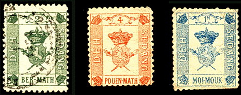
Mayréna went to great lengths to create an aura of legitimacy around his so-called kingdom, producing a variety of paraphernalia such as stamps, medals, and even currency. Many of these items bore inscriptions in the Sedang language—a surprising touch that suggests he must have carefully transcribed the language from Guerlach’s notes before leaving. However, this level of detail was largely wasted, as you could probably count on one hand the number of people who could read and write Sedang at that time. Ironically, none of these symbols of his “kingdom” ever made their way back to the Sedang people.
Stamps of the Kingdom of Sedang. Deh Sedang is how they decided to render Kingdom of Sedang in Sedang language. Math / Mouk was the name of the currency that almost certainly never circulated.
Moi means 1 in Sedang language, I assume “ber” means 2 although it’s generally written pếa these days. “pouen” is similarly probably pún (meaning 4). source: Glosbe
After Hong Kong the king travelled to France hoping for an audience with the president and aiming to open an embassy. He conducted many press interviews at this time but also the press dug up his past to smear his name – recall he’d fled France due to misconduct in the banking industry.
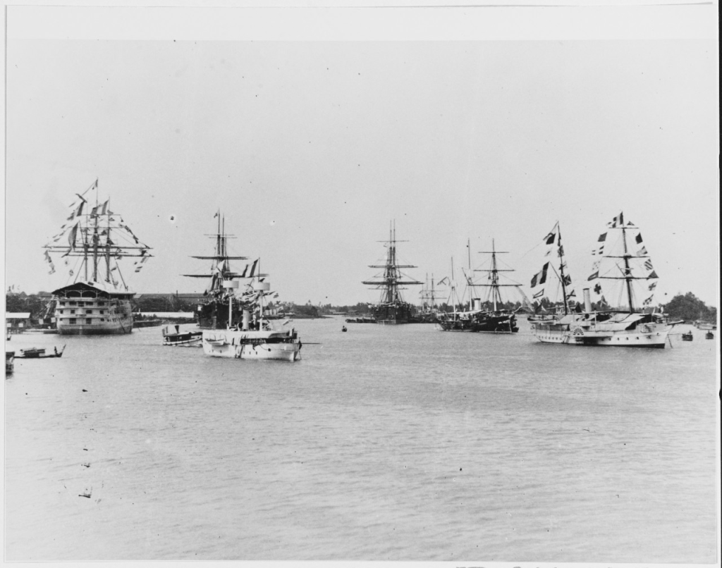
His downfall would begin in April 1889, when a Belgian financier named Somsy agreed to give the self-styled king arms and money in exchange for mineral rights in Sedang. But on his return journey to Vietnam, the French Navy blockaded the ports in order to prevent him reaching Sedang. The arms were then seized as contraband in Singapore. Mayréna’s dreams crushed, fled in to British Malaya.
Warships at Saigon, French Indochina, late 1880’s.
In British Malaya Mayréna would embrace Islam and take several local wives. On November 11, 1890, the life of King Marie I came to a mysterious end. Reports of his death on Tioman Island vary, with claims ranging from poisoning to snakebite or death in a duel.
In early March 1890 – only 2 years after the “founding” of the Kingdom of Sedang – The Resident of France in Quy Nhon lead an sizable force into the Central Highlands to inform the Sedang Mayréna was dead and he would be taking control of the region. This was the start of Kontum being integrated into the French colony. Within the next few years, the French would go on to push to Attapeu and all the way to the Mekong, joining up with their Cambodian colony and taking the southern part of Laos from Siam.
Does any legacy of the so-called Kingdom of Sedang survive today? The short answer is no. While there are a few pieces of memorabilia, such as stamps you can view in Hue museum, in the region itself there is no sign that such a kingdom ever existed. In the 1990s a group in Canada decided to pick up the idea of the failed state. They founded the Assembly For the Restoration of the Sedang Nobility in Montreal on November 2, 1995. They seem to have no connection to Mayréna or the Sedang people or the region. At the time of writing, Their website has not been updated since 2006.
In many ways, The Kingdom of Sedang seems to have been a stunt pulled by a showman and opportunist, a man eager to gain fame and fortune by hook or by crook. For me, the story reminds me of modern-day phenomenon of self-declared micronations like Sealand and Liberland. Indeed, the Kingdom of Sedang wasn’t the first of this kind, for example in 1860 there was The Kingdom of Araucanía and Patagonia. These audacious ventures tap into a deep-rooted human fascination with power and ambition, time and again capturing the public imagination in a way that is both intriguing and entertaining.
In this 2 part post I’m going to recount a remarkable episode in the history of Kontum province, central Vietnam. It follows the escapades of a French cavalryman turned confidence trickster,Marie-Charles David de Mayréna, who ventured beyond the frontiers into lawless winderness. When he got there he did something very unexpected. He declared himself king.
Born in Toulon, France in 1842, Mayréna started his career in the French cavalry where he was involved with the annexation of Vietnam- here he would gain experience which he would draw from with his later ambitions. In 1868, he resigned from the army and returned to France, settling in Paris. Strikingly tall and handsome, Mayréna was a natural seducer and duelist, often seen prowling the Grands Boulevards. His commanding presence, combined with his flair for storytelling, made him a magnet for intrigue and opportunity, as he schemed to make his fortune. After setting himself up as a banker on the Rue de Châteaudun, he was forced to flee the country in 1883 following questionable stock market transactions and a complaint of fraud. He ended up back in Vietnam because he had nowhere else to go.
In Vietnam, Mayréna hopped from one con to another, for example in one scheme he secured government funds for a rubber plantation in Ba Ria, near Saigon. The rubber plantation never existed. His personal life was no less scandalous—he seemed to marry a new woman in every town he passed through, despite already having a wife in France. One such lover, Mayréna claimed, was a princess of the ancient kingdom of Champa, cheated out of her inheritance by Vietnamese warlords. This romanticized fiction was foreshadowing of his later grand ambitions.
In January 1888, word had reached him of an impending Prussian expedition from Siam through the lawless region between the Mekong and the rugged highlands west of Annam – the French colony that is now the Central Coast of Vietnam. The Prussians, looking to exploit recent unrest in Annam, were seeking alliances with local tribes to establish themselves a colonial foothold. They set out from Battambang with a Siamese armed guard headed for Attapeu which would be their base to penetrate deeper into the wilderness.
Like many modern conmen, Mayréna had a sixth sense for turning political turmoil to his financial advantage. Acting quickly; he petitioning the Governor-General to let him intercept the Prussians. The official rebuffed him, due to diplomatic concerns. Undeterred, he quickly reshaped his proposal and offered to lead an unofficial expedition into the highlands west of Annam’s Binh Dinh province. His objective was to secure treaties with the local chiefs before the Prussians could. This time, the Governor-General approved his plan.
The French had already made some inroads into the highland territory, largely due to the efforts of Christian missionaries. These missions had established routes from An Khe in Binh Dinh to Kon Tum, fostering connections with the Bahnar and Rengao peoples. However, standing between the French and Prussian interests in Attapeu was the Sedang tribe. Whichever side could win over the Sedang would gain the upper hand in the region.
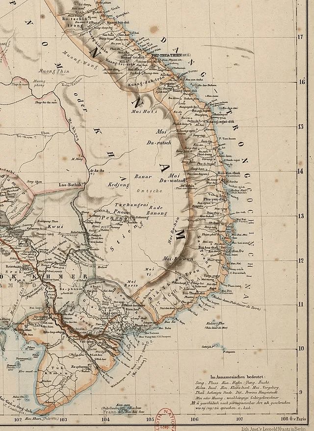
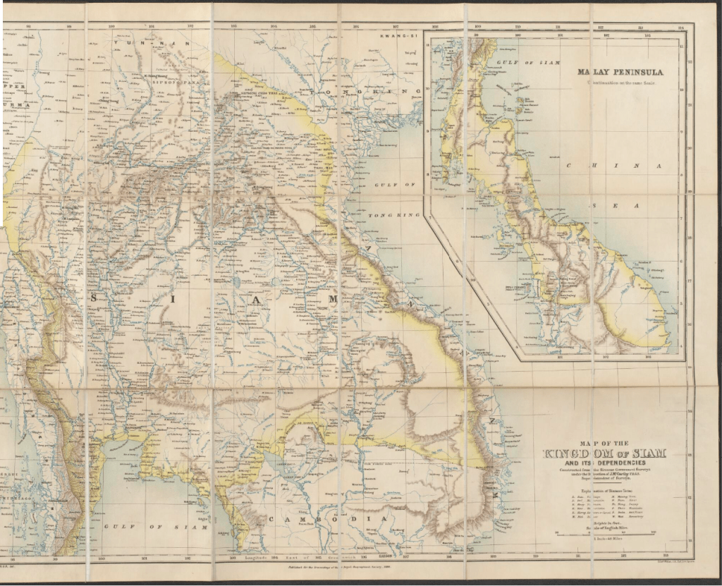
1867 Map showing all the land East of the Mekong as stateless “moi” territory.1888 This British map shows Siam in yellow extending all the way up to the Vietnamese border. The difference between the two maps is due to the politics of the map makers rather than any de facto change since 1867.
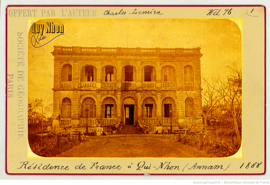
So it was that this ambitious expedition was set in motion. Mayréna and a friend, Alphonse Mercurol, set sail from Ba Ria and arrived in Quy Nhon City, Binh Dinh, in March 1888. Mercurol, like Mayréna, had been a soldier, though dishonorably discharged. Their journey was delayed in Quy Nhon after a mishap with wet gunpowder—while attempting to dry it, they accidentally set it on fire, and Mayréna was badly burned trying to contain the blaze. This setback gave the Prussians a lead and heightened the urgency, as the looming highland rainy season would soon make any expedition nearly impossible. Nevertheless, on April 21, 1888, they finally left Quy Nhon and ventured into the wild west of Annam.
Mayréna would have certainly come here
It was indeed a real column that was heading West! At the head, went David de Mayréna, the Colt at his belt, mounted on a large Arab horse, survivor of the mounts of the Chasseurs d’Afrique of the conquest, then Alphonse Mercurol, Paoli [a cook], the two “congaï” [girls], the four Chinese, prospectors of future gold mines! the interpreter of the Sûreté Pham-Van-San, 18 Saigonese and, finally, 80 coolies carrying baggage! Mayréna has the four hundred piastres that the government coffers generously granted him, weapons, a barrel of powder, canned food of his food officer! Before his departure, he received the wishes of a good journey and the wishes of success from his compatriots of Qui-Nhon – Father François-Xavier VAN CAMELBEKE, Quy Nhon
From Quy Nhon, Mayréna and his party journeyed toward the village of Chief Pim. Educated by missionaries in Kontum, Pim was literate and maintained a friendly relationship with the French. It was at this pivotal location that the expedition would coordinate with the Christian mission, in the form of Father Guerlach.
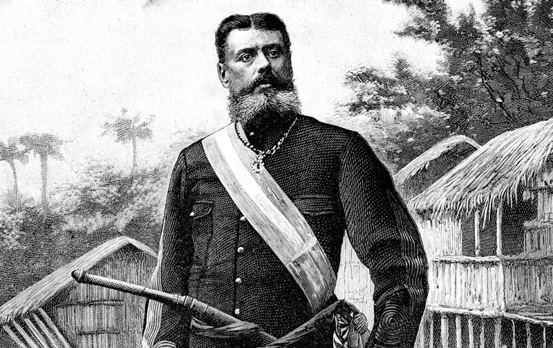
Guerlach was quite the character himself. A missionary based near Kontum, he had mastered several local languages and earned a formidable reputation. During the Cần Vương Revolt of 1887, when Vietnamese rebels targeted Christians, Guerlach—known as Boc Can to the Bahnar—led 200 Bahnar warriors to rout the Vietnamese forces. He later commanded 1,200 warriors against Jrai bandits, this was said to be the largest highland force ever assembled. His influence and respect among the Bahnar and Rengao tribes were unparalleled.
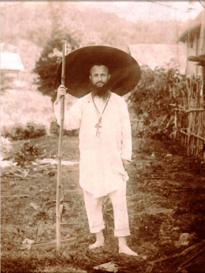
Father Jean-Baptiste-Marie Guerlach
After eleven arduous days of travel, Mayréna’s party ascended from the coastal plains into the high-altitude interior, finally reaching the village of Chief Pim. Nestled among the wooden stilt houses typical of the Montagnard tribes, they were met with the modest yet sincere hospitality of their hosts, providing them with shelter and a brief respite from the trials of the journey. From this temporary refuge, Mayréna’s group sent word to Guerlach, to support the expedition.
I am at Pim’s, and I have not come to ask you to do the corvée of your Christianity here; but you would be very kind to send me some Catholics and your two elephants. I had 100 coolies, but, to use a parliamentary word, the incapacity of the Résident was the cause that at Pim’s they fled. – Mayréna, May 1st 1888
Mayréna’s charm initially proved irresistible to Guerlach, who, as a staunch patriot, was easily persuaded that their goals were aligned. Mayréna deftly presented himself as a champion of both French interests and the Christian faith, convincing the missionary of the nobility of his mission. In response, Guerlach offered significant support, swayed by Mayréna’s apparent dedication to their shared ideals. However, later when Mayréna’s true motives emerged, Guerlach would grow increasingly disillusioned, distancing himself from the conman once he recognized the self-serving nature of his schemes.
On May 10, the entire caravan left the village of Pim and took the road to Kon Jeri Krong(1), where the staff of the commission was installed on Sunday, May 13. Ten days were devoted to rest, installation work and preparations for the first excursion. On May 23, in the evening, we went to sleep at Kon-Tum; on the 24th, we were at Kon-Trang(2), the residence of Father Irigoyen. To celebrate the arrival of our compatriots, the Father gave an ox that the people of the village tied to the post, and the Rolang dance was performed to a large orchestra of drums and tom-toms. Here the expedition truly begins. The caravan consisted of three Frenchmen: Mr. de Mayréna, Mr. Mercurol and myself, two Annamites on horseback, ten savages from my household, who carried our baggage, a pack horse, six Saigonese matas [police officers] who were not very resourceful, except for Doi and finally four Chinese, delegated by Chinese traders from Saigon, to check the presence of gold mines- Guerlach, November 13, to the newspaper Le Courrier d’Haïphong
(1): from this document, it seems that Kon Jeri Krong is now called Kon Jơdreh, a Rengao village near Kon Tum City.(2): Kon Trang is here.
Charles-Marie David de Mayréna
Letters by Guerlach meticulously detail their journey, documenting each village they visited, the exchange of red beaded necklaces for rice, and the nights spent in communal houses. Guerlach was also able to sent locals ahead of the expedition to clear a road as well as keep it safe from bandits. Over the course of three arduous weeks, they steadily approached their final destination – the the Pekau river. At last, they were able to make contact with the Sedang people, as Mayréna himself recounted in a letter.
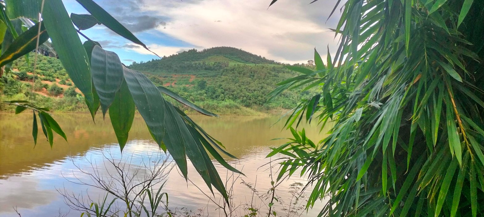
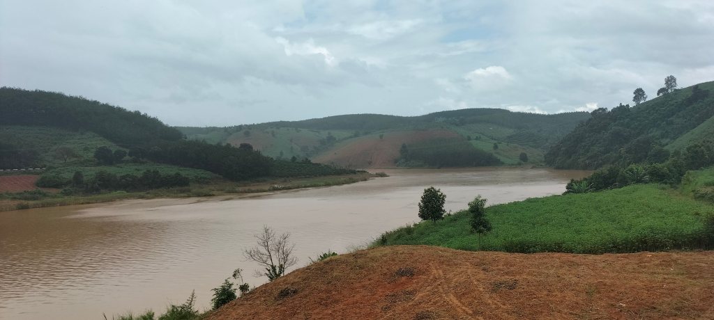
View of the Pekau river. Photo by the author.
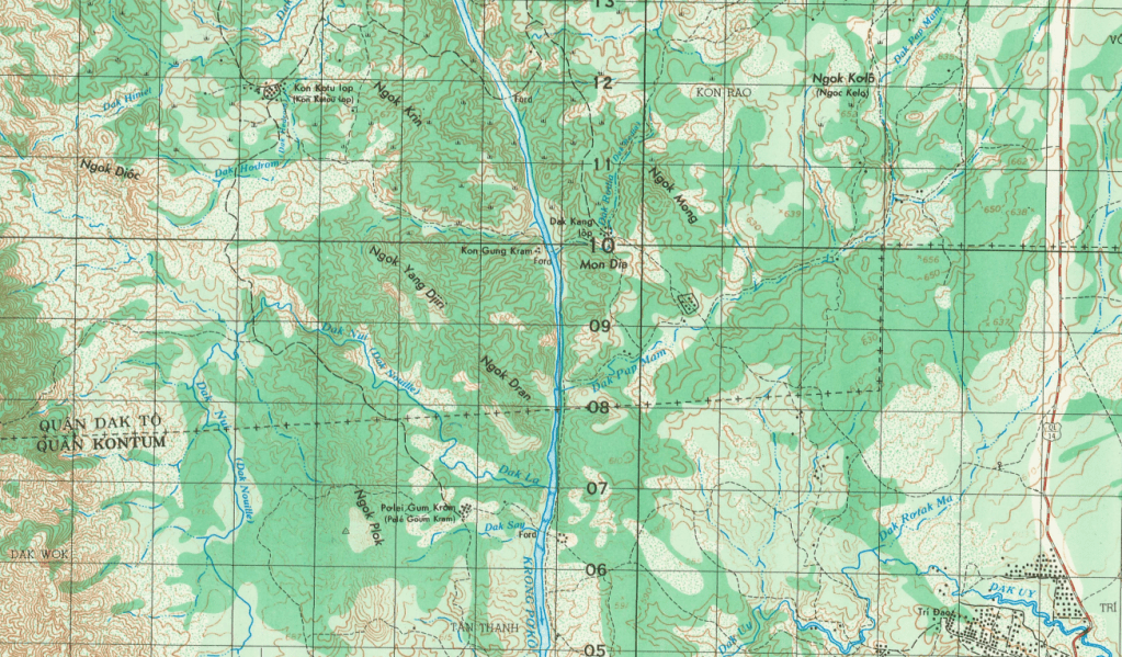
I explained to the Sedangs that I was going to meet Europeans [the Prussians] who wanted to enter their country. My character pleased these untamed nations. It rained as it rains in India, the rivers were transformed into torrents; I remained in the rain, I crossed the rivers by swimming. I thus reached the Pekau. Having crossed this great river, I stopped at the village of Kon-Gung. I was looking for a solution, when the chief of this village, named Sui, made me find it by offering me a war performance. They were very proud of their skill in handling the sabre. I let it happen, then I provoked the victor. After a few parries I succeeded in touching him… I therefore offered to the chiefs and warriors to take me as war chief (tenul bla) or (Kedra bla) — both are said — which was accepted. I was successively appointed by all the villages bordering Pekau. I then had warriors placed blocking the road. He was no longer a French explorer, he was a Sedang chief opposing an invasion. The Prussians learned of this new state of affairs, and withdrew to the right bank of the Mekong, saying that they had the fever – Marie-Charles David de Mayréna, October 8th 1888
Kon Gung and surrounding area in 1970. Now flooded by dams.
The expedition had successfully outmaneuvered the Prussians, eliminating the threat of their influence in the region, but for Mayréna, this was just the beginning. Mayréna’s success emboldened him, revealing selfish ambitions that may have been the force that was driving his actions all along. In part two, we’ll delve into how Mayréna declared himself king, and how this bold move brought him fame and fortune before ultimately leading to his downfall.
My main source for this post is a collection of letters written by those involved collected as a book in 1927 in Bulletin des Amis du Vieux Hue, 14e Année No 1-2 Janv-Juin. If you find getting stuck into the gory details in letter form fun, I highly recommend reading this in its entirety as I found reading it incredibly entertaining and I had to leave out a lot of details here.